A powerful storm system is sweeping across Greece, turning roads into rivers in multiple regions. The severe weather struck many areas of the Aegean, with thunderstorms breaking out from the afternoon of Sunday, November 1. At the same time, extreme weather conditions are spreading into Macedonia and other parts of the country. Flooding was also recorded in Volos and Nea Ionia in the Magnesia region following heavy rainfall that lasted approximately half an hour, beginning shortly after 2:00 PM.
Read more: Storm “Agneta” advances: Warnings issued for severe weather — when and where it will strike (Maps)
The storm hits Lemnos
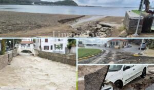
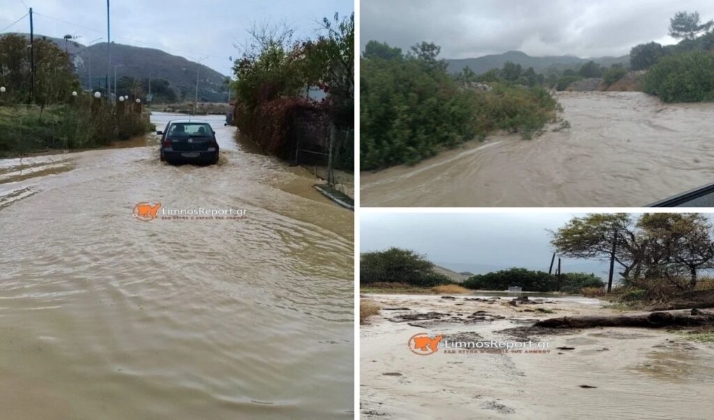
Lemnos stands as a striking example of the damage caused by the fierce storm. A heavy downpour lasting approximately one hour was enough to cause widespread problems on the island’s roads and in its rural areas. The road network was rapidly inundated with large volumes of water, turning streets into rivers, while local streams swelled significantly, carrying large amounts of water and debris.
According to footage published by Limnosreport.gr, roads were submerged and water runoff created significant traffic disruptions. It is worth noting that despite the intensity of the storm and the problems recorded, the situation remained under control. The streams, although considerably swollen, did not appear to cause unmanageable conditions.
Lemnos: Children and parents briefly trapped at sports facility
Particular concern arose when parents and children who were at the “Nikos Samaras” indoor sports facility were temporarily unable to leave the premises for safety reasons. The decision to keep them inside was deemed necessary until the heavy rainfall subsided and safe travel conditions could be ensured. Fortunately, the wait was temporary and everyone was able to leave as soon as conditions allowed.
Storm causes flooding in Magnesia — “Alonaki” area in Nea Anchialos submerged
According to gegonotanews, flooding was also recorded in the Palaia district, on Larisis Street, in Nea Ionia, and in Nea Anchialos. Videos shared by residents on social media show large amounts of water accumulating outside homes. A particularly striking scene was captured at the intersection of Isidorou and Vizantiou streets in Nea Ionia, where water levels reached nearly halfway up a parked car.
The situation in the Alonaki area of Nea Anchialos is especially severe, with roads flooded, homes damaged, and vehicles swept away by floodwaters. Damage was also recorded to key infrastructure, including the sewage network and the municipal street lighting system.
The Kazanorema stream burst its banks beyond the bridge, toward the sea. According to the Thessaly Regional Authority, the watercourses had been cleaned prior to the storm; however, houses built at the stream’s outlet have effectively narrowed its width by half, causing it to become blocked. Regional officials note that while the stream was clear, the encroachment of buildings has left it only half its original width.
Torrents sweep through Kimolos
At the same time, heavy rainfall caused serious problems on the island of Kimolos. Videos posted on social media show large volumes of water rushing forcefully through the island’s streets, making movement extremely difficult.
Meanwhile, the storm has also battered Crete, with difficult conditions prevailing in the White Mountains (Lefka Ori). Travel in mountainous areas requires extra caution, as weather conditions can change rapidly.
Finally, in Rhodes, an emergency warning was issued by the Vatia Community after the stream at “Pigadia” overflowed its banks, while serious flooding was also reported on the island of Thassos.
Images from Thassos:
How the storm system will develop
The 48-hour “Type P” storm system is currently manifesting with rainfall and increased cloud cover, while temperatures remain relatively high for the time of year.
On Sunday (1/11), the most severely affected areas include the Ionian Islands, Epirus, western central Greece, the western and southern Peloponnese, the northern and eastern Aegean islands, and the Dodecanese.
However, according to the emergency bulletin issued by the Hellenic National Meteorological Service (EMY), conditions are expected to intensify on Monday, with severe thunderstorms forecast for the Ionian Islands, Epirus, western central Greece, the western Peloponnese, and the Dodecanese.
The updated emergency weather bulletin from EMY
The Hellenic National Meteorological Service (EMY) has issued an update to its Emergency Weather Deterioration Bulletin, originally published on Saturday, October 31, 2026, under reference number 16/2026, taking into account the latest forecast data. The update confirms there are no substantial changes from the original bulletin. Unsettled weather will persist on Sunday, November 1, and at least through Monday, November 2, primarily affecting western, northern, and eastern island regions. Heavy rainfall and thunderstorms are expected in several areas, with localized hail also possible.
Where severe weather is expected
Today, Sunday, November 1
- Central and eastern Macedonia, through late night.
- Northern and eastern Aegean islands, through late night.
- The Dodecanese.
Tomorrow, Monday, November 2
- The Ionian Islands, from midday onwards.
- Epirus, western central Greece, and the western and southern Peloponnese — primarily coastal and seaside areas — from the afternoon.
- The Dodecanese, intermittently through late night.