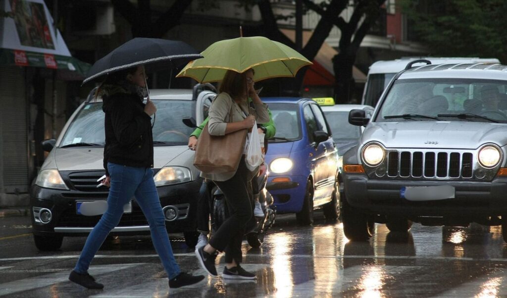
Greece is in the grip of a severe weather system on the country’s national holiday, October 28th, with meteorological forecasts warning of heavy rainfall, thunderstorms, and an elevated risk of flash flooding. Conditions began deteriorating on Tuesday evening (October 27th), with the most intense weather expected to unfold throughout Wednesday, primarily affecting eastern mainland regions and the Aegean Sea.
The Hellenic National Meteorological Service (EMY) has updated its emergency bulletin for dangerous weather phenomena, placing parts of Thessaly, the Sporades, Euboea, and the Dodecanese under red-level warnings. Civil Protection authorities have simultaneously activated heightened readiness measures, with a “Red Code” mobilization in effect for Attica and several Aegean regions.
The severe weather is also casting a shadow over the national holiday celebrations, as authorities have proceeded with cancellations of student parades to prevent risks to pupils, teachers, and the general public.
EMY emergency bulletin: Where the most severe conditions are expected
According to the latest EMY update, the storm system will primarily impact eastern Greece, bringing rain and thunderstorms that may locally be accompanied by hail.
Red warnings are in effect for Magnesia, Larissa, the Sporades, and Euboea, where intense weather conditions are forecast to persist until late at night. The Dodecanese islands are under the same high-danger classification.
An orange warning has been issued for the eastern Aegean islands, where heavy rain and thunderstorms are expected to continue through late evening.
In eastern Central Greece — particularly in Phocis, Phthiotis, and Boeotia — conditions are forecast to reach high intensity at intervals, continuing until late at night.
For Attica, the warning is primarily focused on the early morning hours of Wednesday, with similar conditions anticipated across the western and northern Cyclades.
Particular caution is urged in areas where large volumes of rainfall are expected within a short timeframe, as this significantly increases the risk of localized flooding.
October 28th parades: How the storm will affect Athens and Thessaloniki
Weather conditions are expected to differ significantly between Greece’s two largest cities during the national holiday events.
In Athens, the heaviest rainfall is timed from Tuesday evening through the early morning hours of Wednesday. However, according to ERTnews meteorologist Nikoleta Ziakopoulou, conditions are expected to gradually improve as the hour of the student parade approaches.
In Thessaloniki, where the main military parade is scheduled, forecasts do not indicate weather of sufficient severity to cause significant disruption to the proceedings.
Greater difficulties, however, are anticipated in Magnesia, the Sporades, Euboea, eastern Central Greece, and numerous Aegean islands.
In the Dodecanese and the Cyclades, the intensity of the forecast storms has raised particular concern, with cancellations of commemorative events already announced.
Where student parades have been cancelled due to severe weather
The adverse weather forecasts have prompted regional and municipal authorities to cancel student parades across multiple areas.
In Magnesia and the Northern Sporades, all student parades have been cancelled by decision of the Thessaly Regional Governor, Dimitris Kouretas. This decision applies exclusively to student participants, while decisions regarding other events remain the responsibility of local authorities.
In the Cyclades, student parades will not take place across the Regional Units, with cancellations also extending to the participation of associations, clubs, and organizations.
In the Dodecanese, student parades have been cancelled due to forecasts of severe weather and the heightened flood risk.
In Euboea, cancellations cover Chalkida and the municipalities of Kymi–Aliveri, Mantoudi–Limni–Agia Anna, Dirfyon–Messapion, Eretria, and Skyros.
In Chalkida specifically, according to plans already announced, only the parade of the Infantry School’s Parade Company is expected to take place.
In Agios Dimitrios, Attica, the municipal authority has decided to cancel the scheduled parade.
In the municipality of Zagora–Mouresi, the student parade will likewise not go ahead due to the dangerous weather conditions forecast for the area.
Regarding the military parade in Volos, no final decision had been confirmed in the latest available announcements, with the outcome expected to depend on how the storm develops.
Meteo.gr forecast: Rain, thunderstorms, and mountain snowfall
According to forecast data from meteo.gr, rainfall and thunderstorms are initially expected in Chalkidiki, the eastern and southeastern mainland, the Aegean, and Crete.
From the early morning hours onward, the weather system will spread to parts of Macedonia and Thrace, with a gradual weakening expected from late evening.
Particularly intense rainfall and thunderstorms may occur across the Sporades, Cyclades, and Dodecanese, as well as locally in Euboea and Crete.
Snowfall is also forecast at elevations above 1,200 meters, mainly in Central and Western Macedonia, Thessaly, and parts of Central Greece and Euboea.
Temperatures will drop noticeably, with the lowest readings recorded in Western Macedonia, where the thermometer will range between 1°C and 12°C.
In Thessaly, temperatures of 5°C to 13°C are forecast; in Epirus, 5°C to 17°C; and in Central Greece and the Peloponnese, 7°C to 17°C.
Across the rest of Macedonia and Thrace, readings will range from 7°C to 18°C, while the Ionian islands will see temperatures between 9°C and 18°C.
In the Northern and Eastern Aegean islands, values will range from 12°C to 16°C; in the Cyclades, 12°C to 18°C; while in Crete and the Dodecanese, temperatures may reach up to 20°C.
Winds up to 9 Beaufort — temperature outlook
In addition to heavy rainfall, the storm system is accompanied by strengthening winds, with some forecasts indicating gusts that could locally reach 8 to 9 Beaufort.
According to the detailed meteo.gr forecast, northerly winds of 4 to 6 Beaufort are expected across the Aegean.
In the Ionian Sea, northerly winds of 4 to 6 Beaufort will also prevail, with the possibility of temporary strengthening to 7 Beaufort in northern sections during midday and afternoon hours.
The combination of strong winds and thunderstorms may cause difficulties for transportation, particularly affecting maritime connections.
In Attica, rain and possible isolated thunderstorms are forecast, with northerly winds of 3 to 5 Beaufort. Temperatures in central Athens will range between 12°C and 15°C.
In Thessaloniki, conditions will be characterized by increased cloud cover and occasional local showers. Winds will blow from northwesterly directions at 2 to 4 Beaufort, with central city temperatures ranging between 9°C and 13°C.
When will the storm system ease?
A gradual easing of severe weather conditions is expected to begin from Thursday, October 29th, when an improvement is forecast across most parts of the country.
Temperatures are also expected to rise following the notable drop recorded on the national holiday.
In the meantime, relevant authorities remain on heightened alert, and citizens are urged to monitor official meteorological warnings and local authority announcements — particularly in areas facing an elevated risk of flash flooding.