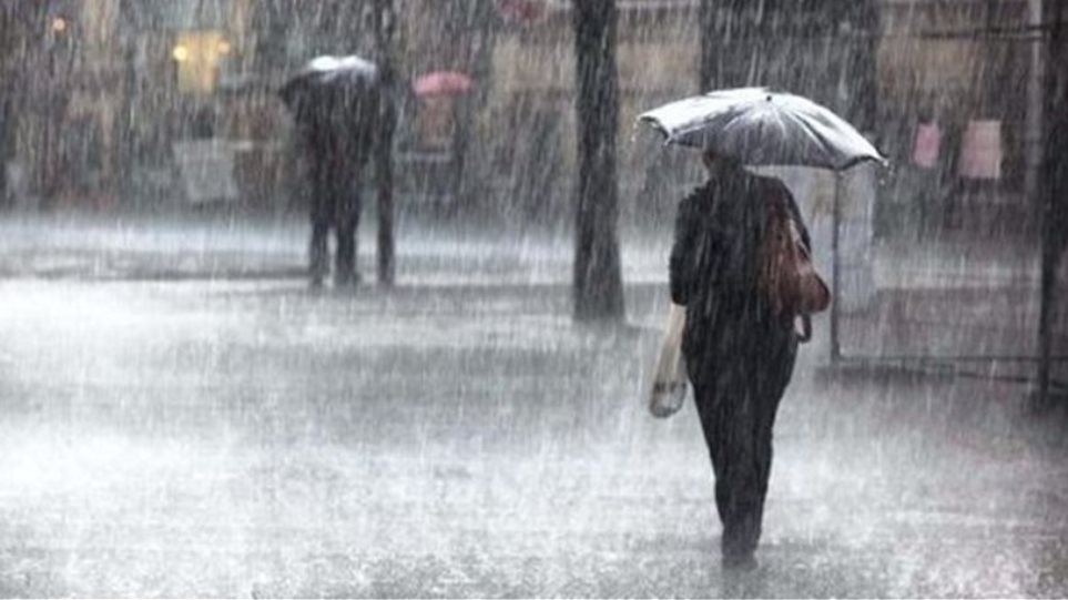
The latest forecasting data converge on a renewed deterioration of the weather on Friday and Saturday, according to meteorologist Yannis Kallianos, due to a low-pressure system from the central Mediterranean moving toward Greek territory. According to Mr. Kallianos, this system, rich in moisture and dynamic instability, is expected to shift toward Turkish regions on Sunday. During its eastward course, it will activate extensive vertical cloud formations (Cumulonimbus-3, Cumulonimbus-9, Tower Cumulus), capable of producing rain and thunderstorms in several areas of the country.
Weather: How Athens will be affected
The meteorologist predicts that rainfall phenomena will begin very early Friday morning in the northern and northwestern parts – mainly in Epirus, western Macedonia and the Ionian islands – and will quickly extend to the remaining western, central and northern mainland areas.
From Friday evening through Saturday dawn, these rains and thunderstorms will also manifest in eastern mainland regions (Eastern Central Greece – Attica, Eastern Peloponnese) and will affect areas of the Aegean Sea.
Mr. Kallianos mentions there is an increased probability of squall line formation during Friday afternoon and evening hours. A squall line is a form of vertical cloud system consisting of a linear or zonal arrangement of organized thunderstorms. On meteorological radars they appear as zones of high reflectivity due to the intensity of precipitation phenomena.
In this case, if the dynamic convergence of air masses is confirmed (there is a small possibility of non-formation of a squall line), the potential squall line may extend from Thrace or the northeastern Aegean, pass through the Sporades, Euboea and Attica, and continue toward the eastern and southeastern Peloponnese, according to the meteorologist. Its movement is estimated to be from northwest to southeast.
According to the meteorologist, the length of such a formation can reach from 100 kilometers to several hundred kilometers, while its lifespan is usually from a few hours to almost half a day. It is often accompanied by gusty winds that can locally reach 8-9 on the Beaufort scale, relative to sudden temperature drops, intense rainfall and possible hailstorms. The arrangement can be continuous (continuous squall line) or broken (broken squall line). Based on current data, from Friday evening through Saturday morning, the phenomena may appear in a more broken form as compact and continuous – extensive cloud masses, as Mr. Kallianos predicts.
According to Yannis Kallianos, this is a meteorological mechanism that has been repeatedly recorded in Greece and falls within the usual phenomena of the cold period. Nevertheless, its intensity and actual impact depend on the system’s dynamics and geographical development. These elements will be clarified with greater certainty as the forecast time horizon decreases and nowcasting confirmation strengthens.


The forecast for Clean Monday
On Sunday the weather will remain relatively unstable mainly in the central and southern parts (local light to moderate rainfall), while from Clean Monday gradual improvement is expected, according to Mr. Kallianos. On Clean Monday the temperature will remain at relatively mild levels for the season, reaching an average of 16-18 degrees Celsius while winds will turn northerly at 4-6 Beaufort and locally up to 7 in the Aegean.
“I must maintain scientific reservation, because the precise organization and structure of a potential squall line depends on subtle atmospheric parameters that are clarified only a few hours before the phenomenon’s manifestation. If the formation is ultimately confirmed – even in broken form and not as a fully continuous line – during the period from Friday afternoon to Saturday morning hours, it will be a phenomenon very familiar to Greek territory,” notes Mr. Kallianos.
At the same time, he notes that similar arrangements of organized thunderstorms are observed several times each year and do not constitute anything unprecedented or extreme for Greece. “However, their spatial development, dynamic organization and impressive linear structure (whether continuous or broken) are elements that always provoke meteorological interest,” he states.