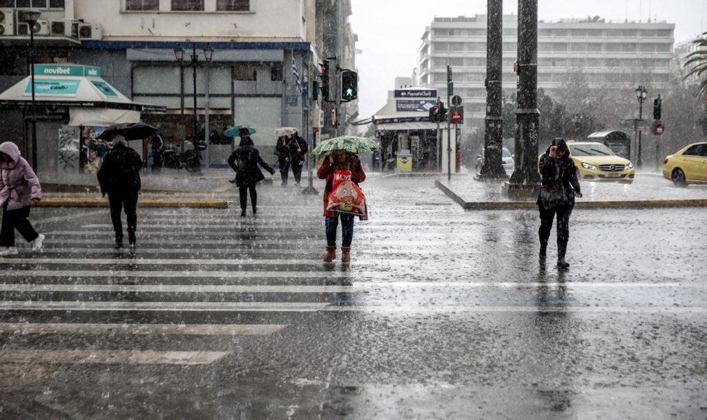
The Hellenic National Meteorological Service has updated its Emergency Weather Warning for Dangerous Weather Phenomena, with the latest forecast data showing significant deterioration of weather conditions across much of the country. The severe weather is expected to affect mainly Sunday, February 1, with heavy rain and thunderstorms that will have not only great intensity but also long duration. According to the forecast, phenomena in many areas will be accompanied by strong winds, with intensities reaching 8 to 9 Beaufort, while local hailstorms cannot be ruled out. At the same time, snowfall is forecast in the mountainous areas of mainland Greece, as well as in the northern semi-mountainous regions, with the phenomenon extending from Sunday afternoon even to lower altitude areas in eastern Macedonia and Thrace.
Weather: Red alert warning issued
Significant areas of the country are placed under red alert warning. In the Peloponnese, severe phenomena are expected from the early hours of Sunday until late afternoon. A similar picture is forecast for Thessaly, as well as the regional units of Pieria, Imathia and Halkidiki, where thunderstorms will begin in the morning and last until the end of the day. In the Eastern Aegean, the red alert warning is in effect from midday hours.
Weather: Orange alert warning and continuation on Monday
The Ionian islands are under orange alert warning, mainly Lefkada, Kefalonia, Ithaca and Zakynthos, as well as Crete, mainly in its western and southern parts. Phenomena are also expected in Epirus, western Central Greece, eastern Central Greece, Attica, Evia, the Dodecanese and areas of Central Macedonia. On Monday, February 2, the phenomena will persist mainly in Crete and the Dodecanese until the morning hours.
Emergency alert 112 activated
Already eight regions and regional units have been placed in Red Code status, while residents of the areas of Achaia, Ilia, Zakynthos and Kefalonia received a warning message at around 22:00 on Saturday evening (31/1) from 112 on their mobile phones. As stated, “due to severe weather phenomena expected in the Regional Units of Achaia, Ilia, Zakynthos and Kefalonia, limit your movements from tonight until the morning hours of Sunday 01-02-2026. Follow the instructions of the Authorities”.
⚠️ Ενεργοποίηση 1️⃣1️⃣2️⃣
🆘 Λόγω έντονων καιρικών φαινομένων που αναμένονται στις Περιφερειακές Ενότητες #Αχαΐας #Ηλείας #Ζακύνθου & #Κεφαλονιάς, περιορίστε τις μετακινήσεις σας από απόψε έως τις πρωινές ώρες της Κυριακής 01-02-2026.
‼️ Ακολουθείτε τις οδηγίες των Αρχών.
ℹ️…
— 112 Greece (@112Greece) January 31, 2026
A short time later, a similar message was sent from 112 to those in the Peloponnese, Thessaly and Sporades.
⚠️ Ενεργοποίηση 1️⃣1️⃣2️⃣
🆘 Λόγω έντονων καιρικών φαινομένων που αναμένονται στην Περιφέρεια #Πελοποννήσου, περιορίστε τις μετακινήσεις σας από απόψε έως τις πρωινές ώρες της Κυριακής 01-02-2026.
‼️ Ακολουθείτε τις οδηγίες των Αρχών.
ℹ️ https://t.co/mbLpAekqgN@pyrosvestiki…
— 112 Greece (@112Greece) January 31, 2026
From midnight, Western Greece will begin to be affected and by dawn strong thunderstorms will develop in Epirus, western Central Greece and western Peloponnese, according to meteorologist Thodoris Kolydas. The meteorologist said that severe phenomena will occur in the Peloponnese, Thessaly and Central Macedonia.
Severe weather: Which areas are under red alert
According to the latest forecast data, the intensity and volume of rainfall phenomena significantly increase the risk of flooding episodes, which led the General Secretariat of Civil Protection to activate red alert in a series of Regions. The Peloponnese Region, Thessaly together with the Sporades, as well as the Regional Units of Achaia and Ilia are in a state of heightened readiness. Similarly, red alert has sounded in areas of Central Macedonia, such as Pieria, Imathia and Halkidiki, where intense long-duration phenomena are expected. The rain and thunderstorms are locally accompanied by stormy winds, which at sea may reach even 8 to 9 Beaufort, while hailstorms cannot be ruled out, mainly in coastal and island areas. At the same time, snowfall is forecast in the mountainous areas of central and northern mainland Greece, as well as at lower altitudes in northeastern Greece, mainly in Evros, from Sunday afternoon.


Weather: Heavy rainfall category 4
According to the Meteo unit of the National Observatory of Athens, the rainfall episode is classified as Category 4, meaning “Very Significant”, which reflects the seriousness of the situation. Forecast models show the gradual movement of the low pressure system from west to east, with phenomena weakening from the early hours of Monday. Of particular interest is the weather development in Attica. According to meteorologists, the severe weather is expected to affect the basin from the early morning hours of Sunday. Although rainfall amounts are estimated to be smaller compared to previous episodes, citizens are called to exercise caution due to the intensity of the phenomena and strong winds.