The climate phenomenon El Niño is now in full swing, as NASA has officially confirmed. The determination was based on detailed satellite observations that recorded significant changes in sea surface height across the entire Pacific Ocean.
Read also: El Niño returns stronger than ever: Which regions will be affected and what this summer holds
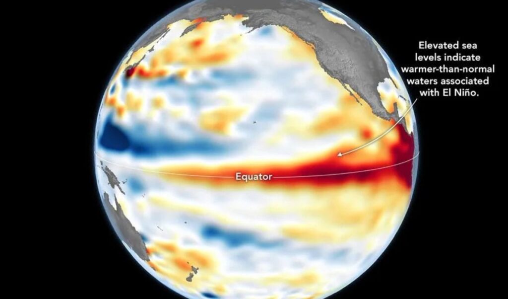
Specifically, data collected by the advanced Sentinel-6 Michael Freilich satellite showed that water levels are noticeably elevated across various areas of the equatorial Pacific. According to NASA scientists, this rise serves as undeniable evidence of increasing temperatures, as ocean waters expand in volume when they warm — making sea surface height one of the most reliable indicators for studying the oceans.
Although the U.S. National Oceanic and Atmospheric Administration (NOAA) had already officially announced the onset of El Niño on June 11, NASA notes that the latest observations provide “supplementary evidence” confirming the climate phenomenon. The space agency also warned that this particular El Niño will cause “widespread impacts.” These include increased rainfall across the southwestern United States, as well as drought conditions in western Pacific countries such as Indonesia and Australia. Meanwhile, experts estimate that nearly the entire planet will experience extreme heat.
The data processed by NASA’s Jet Propulsion Laboratory was sourced from Sentinel-6 recordings taken on June 8.
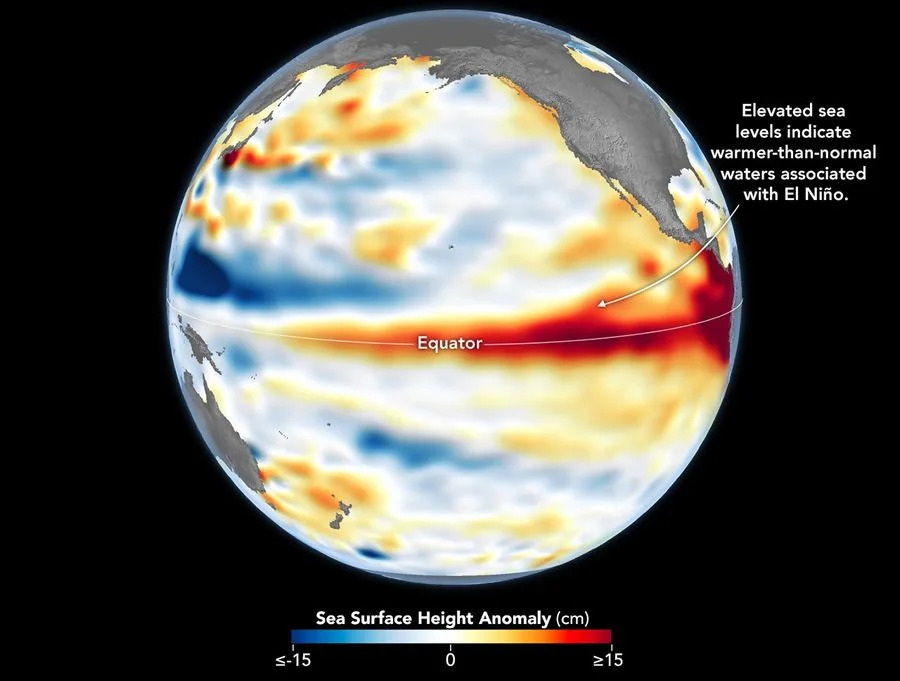
On the corresponding maps, red areas indicate above-normal sea levels, white areas represent normal conditions, and blue areas show below-normal levels.
As early as the beginning of spring, the satellite had detected enormous masses of warm water — hundreds of kilometers wide — moving from the western to the eastern Pacific. These phenomena, known as Kelvin waves, are considered a key precursor to El Niño and, according to NASA, “occur when trade winds in the western equatorial Pacific weaken and then temporarily reverse, blowing from the west.”
“Warm water accumulates in the east, increasing the thickness of the warm surface layer, reducing the depth of the thermocline, and suppressing the upwelling of cold water that normally keeps waters cooler along the Pacific coasts of the Americas. This buildup of heat beneath the ocean surface is precisely what sea surface height observations capture,” NASA explained, noting that this measurement goes beyond simply recording surface temperature — it reveals how much heat is stored in the deeper layers of the water. “This is important because a shallow warm layer may have little effect on climate and weather, while a large reservoir of heat beneath the surface can play a far more decisive role.”
Sentinel-6 deputy science lead Dr. Severine Fournier noted that the conditions recorded on June 8 strongly resemble those of 1997, when one of the most powerful El Niño events on record occurred. As she pointed out, there are indications that this year’s event could develop into a particularly strong one, though additional observations are still required.
What are the impacts of El Niño?
According to the World Meteorological Organization, above-normal temperatures are expected in “almost every part of the planet,” with the strongest thermal anomalies anticipated across southern and western North America, Central America, the Caribbean, Europe, North Africa, and much of Asia.
At the same time, El Niño is expected to significantly affect rainfall patterns worldwide, bringing increased precipitation to parts of South America, the southern United States, East Africa, and Central Asia, while drier conditions are forecast for Central America, northern South America, the Caribbean, Australia, Indonesia, and parts of South Asia. Additionally, during the Northern Hemisphere summer, the warm waters associated with El Niño may intensify hurricane formation in the central and eastern Pacific, while simultaneously suppressing Atlantic hurricane development.
*Photo: NASA