
Those enjoying the sunny Saturday of October 10th would do well to savor it — because the weather is about to change, and it’s uncertain when skies this clear will return. Forecasts confirm that a frontal depression is positioned between Greece and Italy, set to push into Greek territory from the afternoon of that same day, beginning from the western regions. The change is now a matter of hours — and rainfall is expected to sweep across most of the country, including Attica, where a rain front is forecast to persist for approximately three days — through the morning of Thursday, October 15th, according to okairos.gr.
Weather forecast: what Weather Phenomena is predicting
The main precipitation front will move in from the west during Saturday afternoon and spread eastward through Sunday, where conditions at a local level could turn severe.
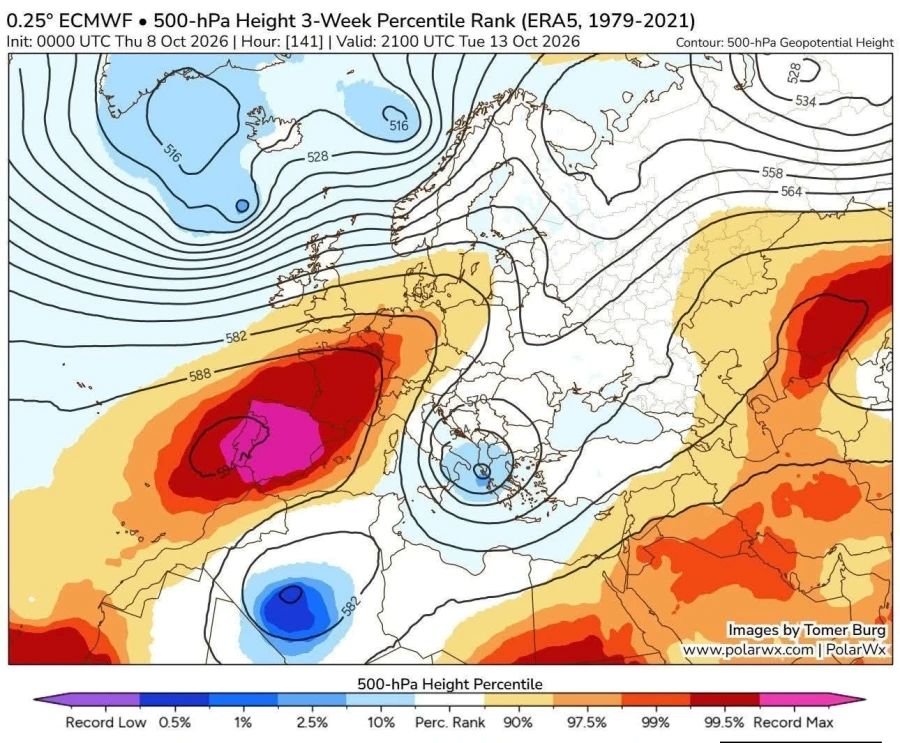
The cause is a frontal depression currently sitting between Italy and Greece, moving at a relatively slow pace — a key factor in why weather conditions across the country have remained stable until now.
Once we accept that the atmosphere operates by its own laws and that everything is subject to the laws of probability (a solid grasp of mathematics helps here), we may find ourselves a little more forgiving toward meteorologists. Weather forecasting models can identify a frontal depression and approximate its likely trajectory, but the atmosphere doesn’t work like the watch on your wrist, ticking off seconds with precision. And of course, no forecast can tell you whether it will rain specifically in your backyard.
A low-pressure system can shift behavior every six hours, either intensifying or weakening in ways that are difficult to predict with certainty. Our job is to keep the public informed, understanding that both hits and misses are part of meteorology. It must be recognized that humans will never be able to predict atmospheric behavior down to the millimeter — despite the enormous technological advances made in this field of science.
Weather conditions will turn rainy from Saturday, October 10th through the following week, but the rain won’t arrive on anyone’s schedule. It will come when atmospheric conditions allow — and more specifically, when this low-pressure system finally breaks free from the Ionian Sea, where it has remained stalled.
And rest assured: weather analysis is not done by reading colors on a map. It relies on specific differential mathematical equations, specific isobaric pressure levels, ensemble models, and much more. Weather is not a trolleybus running on a fixed route — it is an extraordinarily complex physical mechanism of this planet.
The forecast from meteorologist Dimitris Ziakopoulos
Meteorologist Dimitris Ziakopoulos breaks it down as follows:
(a) Thermal atmospheric instability may be a hallmark of the summer season, but it can also occur outside of it — with lower solar radiation intensity and duration — when the right structural conditions develop in the atmosphere. A prime example is the localized showers and isolated thunderstorms expected on Saturday across several areas of mainland Greece. Disturbance D1 will also play a role in triggering this instability.
(b) On Sunday, Disturbance D2 will bring rain and localized thunderstorms to the Ionian Sea, the Greek mainland, and the northern and northeastern Aegean. Conditions in northeastern Greece — including the islands of the eastern and northeastern Aegean — will develop mainly overnight into Monday, persisting through approximately midday. It should be noted that in western and northwestern Greece — specifically the northern Ionian, Epirus, and western central Greece — rainfall and thunderstorms will be locally intense. Disturbance D3, which follows, will generate limited instability conditions in areas where additional contributing factors align.
(c) On the Monday chart (12/10), we can clearly observe the downstream development mechanism of atmospheric waves. The jet stream maximum over the northeastern Atlantic — which may result from a merger of the polar and subtropical jet streams — is what will trigger the descent of cold air masses, first toward central-eastern Europe and then toward the Balkans. This development is significant and will demand our full attention as it unfolds.