The entire country is in the grip of a heat wave, however, temperatures appear to be dropping in the coming days and returning to normal seasonal levels, while weather deterioration is expected from Thursday. The forecasts for August are particularly interesting.
In his analysis, Dimitris Kambolis, Physicist specializing in Environment and Meteorology, MSc in Environmental Studies and Climate Change PhD candidate, Department of Geology and Geoenvironment at the National and Kapodistrian University of Athens, EMTE member (Hellenic Meteorological Society), AMS member (American Meteorological Society) reports on YouWeather.com:
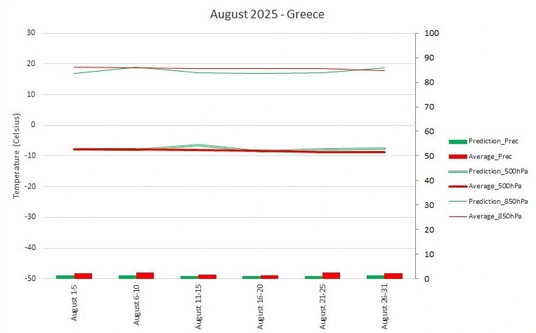
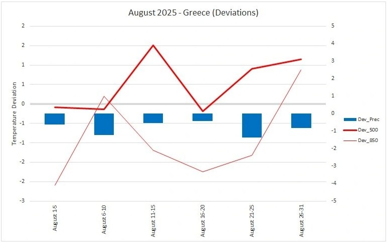
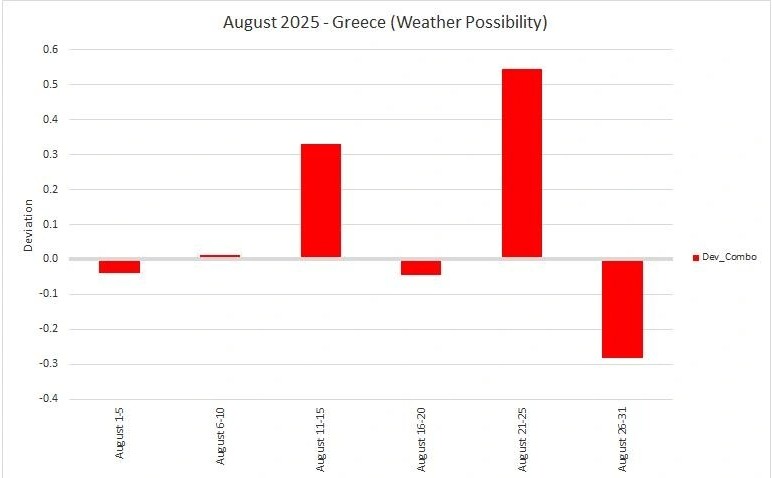
Weather in Greece for August 2025 – YSM (YouWeather Statistical Model)
August
1-10: Temperatures at normal or slightly lower levels than average climatic values (temperature rise towards the end of the 10-day period in western and southern mainland and island regions). Increased instability with locally intense rainfall and thunderstorms at times in western, central and northern mainland areas.
11-20: Temperature drop to normal or slightly lower levels than average climatic values in eastern and southern regions. Heat in western and northern areas. Strengthened northerly winds in the Aegean Sea.
21-31: Temperature rise to levels higher than average climatic values (possible intense heat wave towards the end of the month). Sporadic instability in parts of western, central and northern mainland Greece.