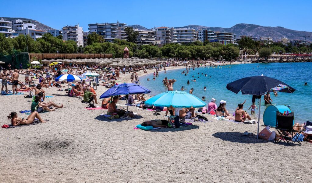
June weather will begin with absolutely summer-like conditions, as temperatures across Greece on Pentecost Monday are expected to exceed 30 degrees Celsius. Meanwhile, Europe continues to suffer from a severe heatwave affecting both major capitals and other regions, with temperatures rising 10 to 15 degrees above the usual average for this season. While Greece has not been affected by the heat dome phenomenon that has encircled Europe in recent days, it is already experiencing intense heat that appears to be here to stay. Today, Saturday, May 30, 2026, and throughout the Pentecost weekend, the weather is forecast to be excellent with high temperatures reaching up to 30 degrees in many areas. This warm atmosphere is expected to continue throughout the first week of June, except for possible local storms in mountainous areas from Wednesday.
Weather forecast for Greece on Sunday, May 31
The weather is forecast to be generally clear, with local clouds during midday and afternoon hours in mainland areas. Local showers are expected in mountainous regions, while isolated thunderstorms may occur in western and northern areas. Winds will blow from the west, with intensity 2 to 4 Beaufort. Temperature will rise slightly, reaching 28 to 31 degrees in most areas, while locally in northern and eastern mainland areas it may touch 32 degrees Celsius.
MACEDONIA, THRACE
- Weather: Generally clear with local clouds during midday and afternoon hours in mainland areas where local showers will occur in mountainous regions and isolated thunderstorms in eastern mountains.
- Winds: Variable 2 to 4 Beaufort and during midday and afternoon hours southerly with the same intensity.
- Temperature: From 12 to 32 degrees Celsius. In western Macedonia the minimum 2 to 3 degrees lower.
IONIAN ISLANDS, EPIRUS, WESTERN CENTRAL GREECE, WESTERN PELOPONNESE
- Weather: Generally clear with temporary local clouds during midday and afternoon hours in mainland areas where local showers and isolated thunderstorms will occur in mountainous regions.
- Winds: Western northwesterly 2 to 4 Beaufort.
- Temperature: From 16 to 31 degrees Celsius.
THESSALY, EASTERN CENTRAL GREECE, EVIA, EASTERN PELOPONNESE
- Weather: Generally clear with temporary local clouds during midday and afternoon hours in mainland mountainous areas where local showers may possibly occur.
- Winds: Southern southwesterly 2 to 4 Beaufort.
- Temperature: From 12 to 32 degrees Celsius.
CYCLADES, CRETE
- Weather: Generally clear.
- Winds: Western southwesterly 3 to 4 Beaufort.
- Temperature: From 17 to 27 degrees Celsius.
EASTERN AEGEAN ISLANDS – DODECANESE
- Weather: Generally clear.
- Winds: Western southwesterly 3 to 4 and in the south northwesterly up to 5 Beaufort.
- Temperature: From 17 to 28 degrees Celsius.
ATTICA
- Weather: Generally clear.
- Winds: Southern southwesterly 2 to 4 Beaufort.
- Temperature: From 16 to 30 degrees Celsius.
THESSALONIKI
- Weather: Generally clear with temporary local clouds during midday and afternoon hours when local showers may possibly occur in mountainous areas.
- Winds: Southern 2 to 3 Beaufort.
- Temperature: From 15 to 30 degrees Celsius.
Forecast for Pentecost Monday (01/06)
Generally clear weather. During midday and afternoon hours clouds will develop in mainland areas and local showers and isolated thunderstorms will occur in mountainous regions. From late afternoon phenomena may possibly occur in plain areas of central Macedonia. Visibility during morning hours in western areas will be locally limited. Winds will blow southwesterly 3 to 5 Beaufort. Temperature will show a slight rise, reaching 29 to 31 degrees in most areas and locally in northern and eastern mainland areas 32 to 33 degrees Celsius.
Weather forecast from Tuesday, June 2
Generally clear weather. During midday and afternoon hours clouds will develop in mainland areas and local showers and isolated thunderstorms will occur in central and northern regions mainly in mountainous areas. Visibility during morning hours will be locally limited. Winds will blow from southern directions 3 to 5 Beaufort. Temperature will not show significant change.
Weather forecast for Wednesday, June 3
Generally clear weather with temporary clouds in mainland areas during midday and afternoon hours. Visibility during morning hours will be locally limited. Winds will blow from southern directions 3 to 5 Beaufort. Temperature will not show significant change.
Weather forecast for Thursday, June 4
In northern-northwestern country initially clear weather and from midday clouds with local rains and thunderstorms. In the rest of the country generally clear weather with temporary local clouds. Visibility during morning hours in eastern areas will be locally limited. Winds will blow from southern directions 3 to 5 and locally in open seas temporarily 6 Beaufort. Temperature will show a slight drop in northwestern country.
Weather: Heat dome devastates Western Europe with 18 deaths
In the rest of Europe, the heatwave has proven extremely dangerous, already counting 11 victims in Britain and 7 in France. Residents and tourists desperately seek ways to cool down, taking refuge in shade, lakes, rivers and even fountains. The “heat dome” phenomenon, primarily affecting western countries, is connected to a high-pressure zone that traps warm air masses from North Africa. Meteorologists explain it functions like an atmospheric lid, preventing fresh air circulation and intensifying heat accumulation.
Britain “melts” as Paris declares orange alert
In Britain, authorities have recorded 11 deaths as the country suffers from particularly high temperatures exceeding 30°C – levels rare even for summer months. Temperature reached 34.8°C at Kew Gardens in London, surpassing the previous May record of 32.8°C set in 1922 and repeated in 1944. This record was broken again the following day when mercury touched 35.1°C. Meanwhile, the country experiences consecutive “tropical nights” when temperature doesn’t drop below 20°C, extremely rare for May in Britain. Extended high temperatures cause intense concern as most homes and infrastructure aren’t built to cope with such hot climates.
In France, the heatwave has led to seven deaths according to local authorities. Among these, a man suffered cardiac arrest while exercising in Paris, while another incident occurred in Lyon under similar conditions. In some French regions temperatures have reached up to 39°C, with dozens of departments under orange alert – rare for May. Paris and nearby departments Hauts-de-Seine, Seine-Saint-Denis and Val-de-Marne have declared heightened vigilance, while emergency measures have been implemented to reduce traffic in the Île-de-France region. Western France and Atlantic coasts are particularly affected by high temperatures. These areas, usually benefiting from the Atlantic Ocean’s cooling effect, are recording unprecedented temperatures for the season. The phenomenon is attributed to the strong “heat dome” formed over Western Europe, causing unprecedented heat conditions.
Temperatures reach 40°C in Spain
In Spain, the heatwave has raised temperatures to levels usually observed in July and August. Despite May beginning with temperatures lower than normal averages, from May 19 there was a sudden and lasting rise. In many regions like Andalusia, Extremadura and the Ebro valley, temperatures range between 37°C and 39°C, while some areas are forecast to reach even 40°C. For the first time in May, the city of Badajoz recorded temperatures exceeding 38°C, according to measurements covering 71 years. Meanwhile, Santander airport has already recorded six days with temperatures above 30°C before June even begins, something that has only happened twice since 1954. Most affected areas include Seville, Córdoba, Jaén, Toledo, Zaragoza and Lleida. However, rising temperatures in northern regions are also concerning.
Weather: Red alert in Italy and heat records in Portugal
Italy is in heightened alert as the heatwave affects major cities like Rome, Florence, Bologna and Turin. The Health Ministry has issued red alert for these areas where temperatures are expected to be extremely high. Specifically, thermometers are forecast to reach 33°C in Turin, 32°C in Florence and Bologna, with perceived temperature reaching up to 35°C. In Rome, temperatures around 31°C are expected, with perceived temperature nearly 33°C. Authorities warn the heatwave is dangerous not only for vulnerable populations but also for those otherwise healthy and active, emphasizing the need for caution from everyone. Alert level 3 activates when continuous extreme temperatures are detected for at least three days. Since May 25, the Health Ministry provides daily detailed heatwave forecasts for 27 cities with 24, 48 and 72-hour horizons.
Similar conditions prevail in Portugal, where an early heatwave raises temperatures to historic levels for the season. According to the country’s meteorological service, temperature has reached 40.3°C, surpassing the previous May high recorded in 2001 at 40°C. Heat has been recorded since May 20 and experts estimate extreme conditions may last until early June. Portugal, like many Western European countries, experiences temperatures well above the climatic average for the season. Climate crisis has cast its worrying shadow again, as impacts become increasingly felt in the natural environment and people’s lives. The need for immediate action and adaptation to the planet’s new challenges is more urgent than ever.