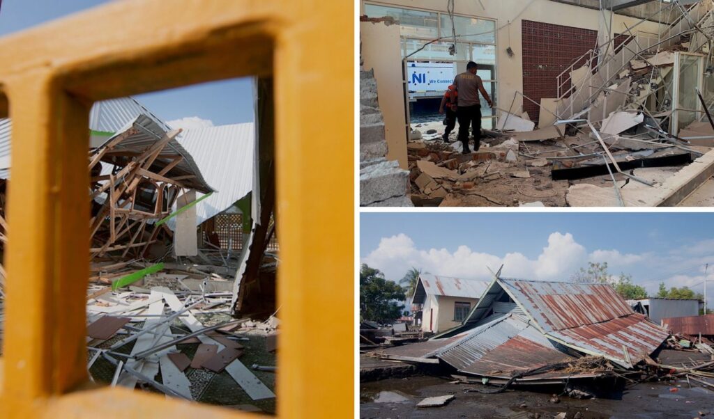
At least 38 people have lost their lives in Indonesia following a powerful earthquake measuring 7.7 magnitude that struck in the early hours of Saturday (15/08) off the eastern coast of the country. The quake was felt across all of East Nusa Tenggara, West Nusa Tenggara, and parts of South Sulawesi, with residents in several areas reporting that the tremor lasted approximately one minute, according to a statement from the BNPB. “Most people felt the shaking and ran out of their homes,” the agency said.
According to the head of Indonesia’s National Disaster Management Agency (BNPB), “the deaths of 38 people have been confirmed, two others were seriously injured, 11 sustained minor injuries, and approximately 2,000 people evacuated their homes of their own accord,” he said.
The earthquake struck at 05:58 a.m. local Flores time — 00:58 Greek time — in the sea to the north of the island. The United States Geological Survey (USGS) placed the epicenter approximately 68 kilometers north-northwest of the city of Ende and estimated the focal depth at 10 kilometers.
Indonesia earthquake: 38 dead and dozens injured
Indonesia’s Meteorology and Geophysics Agency (BMKG) located the epicenter approximately 30 kilometers northeast of Mbay, in the Nagekeo regency, at a depth of 15 kilometers. These minor discrepancies are common in initial analyses conducted by different seismological networks.
Authorities fear the death toll may rise, as rescue teams had not yet been able to reach all communities in Nagekeo — the area closest to the epicenter. Landslides blocked road access, while power outages and damage to telecommunications networks are hampering the flow of information.
In Maumere, the largest city in Sikka regency and one of Flores Island’s most important ports, part of a building at the port terminal collapsed in a cloud of dust. Video verified by Reuters captured people running in panic through the streets as sections of the structure crumbled into rubble.
🚨 The earthquake in Indonesia was magnitude 7.7. For many people, the early morning began with disaster. 🇮🇩#Indonesia #Earthquake #BreakingNews #EarthquakeAlert pic.twitter.com/c4edaQnCEh
— Mahrosh Pervaiz (@MahroshPervaiz1) August 15, 2026
The tremor lasted nearly one minute
Residents of the affected area described an exceptionally powerful tremor lasting approximately one minute. Houses and public buildings suffered cracks or partial collapses, while footage from Ruteng and other towns showed walls and roofs that had given way.
At hospitals in Ende and other areas, patients were rushed to open spaces. Doctors and nurses set up temporary treatment stations outside the buildings, moving beds, oxygen tanks, and IV drips, as there were fears of further collapses triggered by aftershocks.
The first official damage assessment
The BNPB’s initial official report included two houses with severe damage, one with moderate damage, and two with minor damage, as well as damage to a government food warehouse, public facilities, and six government buildings. The agency noted, however, that the list was incomplete and was expected to grow as rescue teams gained access to the worst-affected areas.
Landslides also struck Ende regency, cutting off traffic on the Trans-Flores Highway — the island’s main road artery, approximately 700 kilometers long. The Indonesian government deployed a helicopter to transport personnel, supplies, and injured residents, as the rugged terrain and island geography severely limit overland access.
Tsunami warnings issued
Immediately after the earthquake, the BMKG issued tsunami warnings for coastal areas of East and West Nusa Tenggara, South Sulawesi, and Southeast Sulawesi. The first alert was issued just two minutes and sixteen seconds after the main tremor, with authorities urging residents to leave coastal areas and move to higher ground.
Around 2,000 residents were evacuated in Nagekeo regency alone, with similar evacuations carried out in Sikka, West Manggarai, and the city of Bima. Roads filled with cars and motorcycles as families tried to move away from the coast in the darkness.
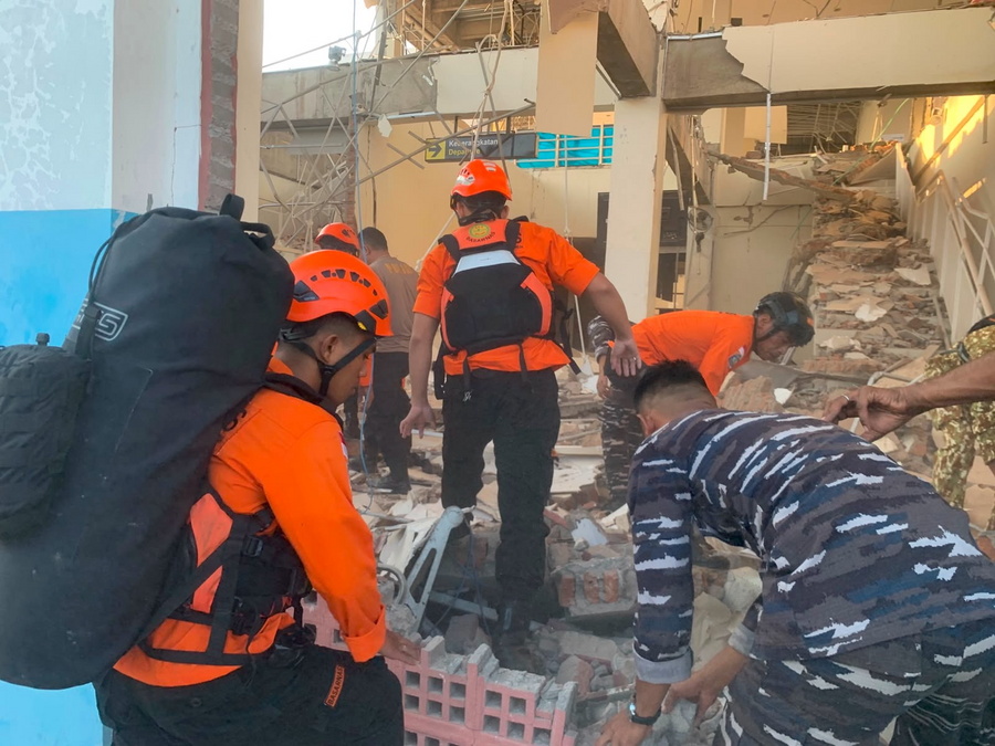
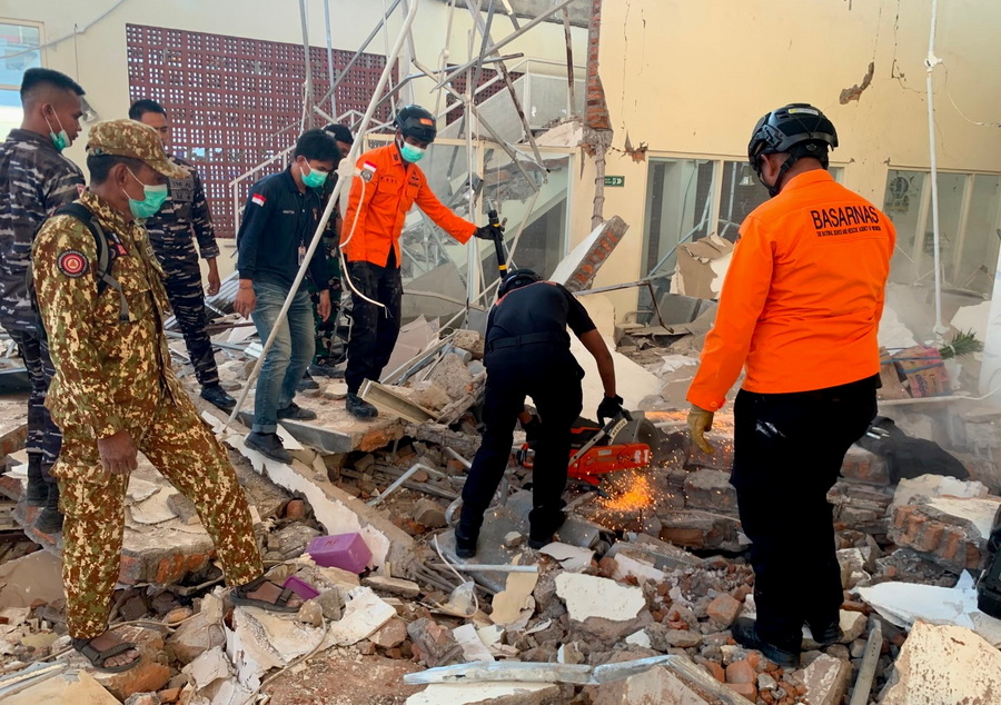
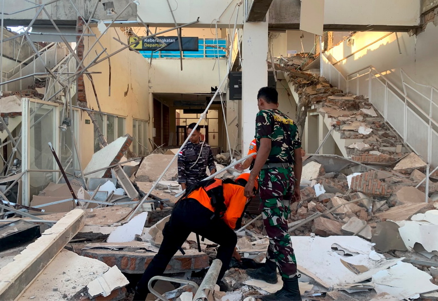
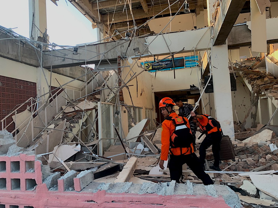
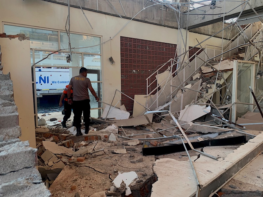
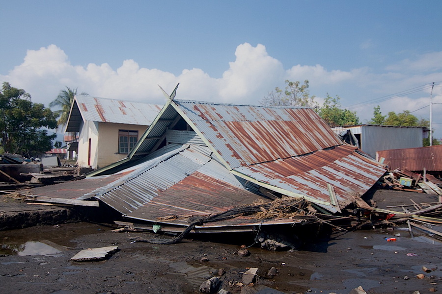
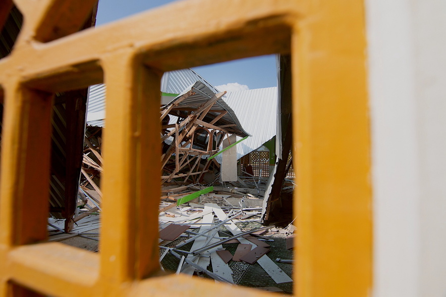
Small tsunami waves of less than one meter were recorded at certain monitoring stations. However, sea levels did not change significantly enough to cause serious destruction, and the BMKG lifted the tsunami warning at 07:31 Jakarta time — approximately two and a half hours after the earthquake. Authorities continued to monitor sea levels nonetheless and advised residents not to return to buildings showing visible cracks or other damage.
Intense aftershock activity followed
The main tremor was followed by intense aftershock activity. According to the BNPB, two strong aftershocks of magnitude 6.2 were recorded at 05:13 and 05:28 Jakarta time, followed by tremors of magnitude 5.6 and 5.5. Dozens of smaller quakes followed, keeping residents outside their homes. Seismologists warned that strong aftershocks are to be expected following such a large and shallow earthquake. This does not mean their intensity or timing can be accurately predicted, but it does increase the risk of collapse for structures that have already sustained damage.
The shallow focal depth was a decisive factor in the intensity of the shaking felt at the surface. The BMKG estimated that in the areas of Aeesesa, Riung, and Mbay, the intensity reached level VII on the Mercalli scale — at which damage is likely even in relatively well-built structures.
The Ring of Fire
It is worth noting that Indonesia lies within the so-called Pacific “Ring of Fire” — a highly seismically active zone where various tectonic plates meet, generating intense seismic and volcanic activity. The Ring of Fire, or Circum-Pacific Belt, is not a single geological formation nor a literal circle. It is a vast, horseshoe-shaped zone of seismic faults, oceanic trenches, and volcanoes that encircles the Pacific Ocean, stretching from the western coast of the Americas to Japan, the Philippines, Indonesia, and New Zealand.
What causes the phenomenon
As explained by the USGS and the U.S. National Oceanic and Atmospheric Administration (NOAA), in this region the Pacific Plate and other tectonic plates collide, slide past, or subduct beneath one another. During subduction, enormous quantities of energy accumulate and are then released as earthquakes, while the melting of materials at depth fuels chains of active volcanoes.
Approximately 90% of the world’s earthquakes and 81% of the most powerful earthquakes are recorded along this zone, according to the USGS. Indonesia is particularly vulnerable because its vast archipelago sits at the convergence of multiple tectonic plates and is crossed by active faults and volcanic arcs.
Being located within the Ring of Fire does not mean that one earthquake will automatically trigger another in a distant country within the same zone. Most seismic sequences are linked to local faults, and earthquakes occurring close together in time at different points around the Pacific do not, in themselves, constitute proof of a direct connection.
The haunting memories of 1992
Finally, it is worth recalling that Flores Island has experienced a far greater tragedy in the past. On December 12, 1992, a magnitude 7.5 earthquake triggered a devastating tsunami that reached parts of the coastline in just five minutes. According to historical data from NOAA, at least 2,080 people were killed or went missing, including approximately 1,490 in Maumere and 700 on the small island of Babi.
The memory of that disaster explains both the speed with which today’s authorities activated the warning system and the swiftness with which residents abandoned the coastlines. Although no destructive tsunami was recorded this time, the earthquake has left behind human casualties, damaged buildings, and communities anxiously awaiting the completion of search and rescue operations.
With rescue operations ongoing, communications remaining disrupted, and several areas still yet to be assessed, the death toll is considered preliminary. The full scale of the disaster is expected to become clear as teams reach the more isolated communities of Flores Island.
A powerful 7.7-magnitude undersea earthquake struck off the northern coast of Indonesia’s Flores Island, triggering tsunami warnings across several coastal provinces. Indonesian meteorological agencies urged residents in impacted areas to evacuate immediately to higher ground and… pic.twitter.com/lcbLMBfpfy
— The Weather Channel (@weatherchannel) August 15, 2026