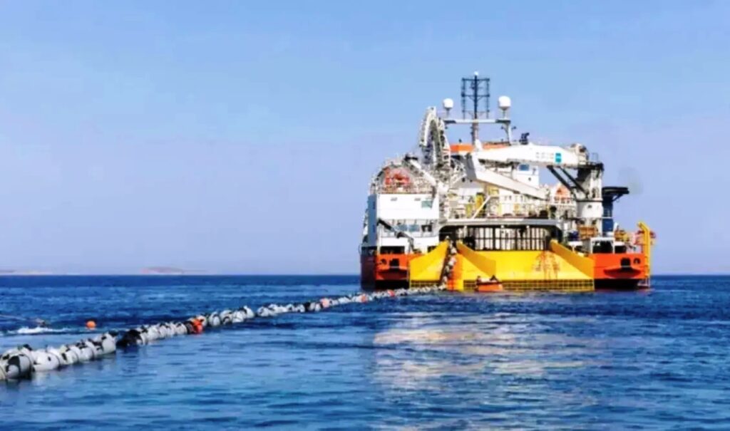
A new Turkish NAVTEX notice covering maritime areas south of Rhodes, east of Crete, and west of Cyprus is raising serious concerns about Ankara’s territorial claims in the Eastern Mediterranean. The notice concerns planned geophysical survey operations by the vessel KOBI RUEGG, scheduled to begin on October 21 in connection with the East to Med Corridor (EMC) submarine data cable system. Turkey is presenting this activity as approved and coordinated by its competent authorities, despite the fact that the published coordinates overlap with maritime zones over which Greece and the Republic of Cyprus assert sovereign rights.
Turkish NAVTEX: The areas it covers
The new notice to mariners covers two extensive maritime routes in the Eastern Mediterranean. According to the published information, the coordinates stretch from areas south of Rhodes and east of Crete to the maritime zone west of Cyprus. Through this announcement, Turkey is attempting to present these areas as part of the continental shelf it claims. This approach is consistent with Turkey’s longstanding positions on maritime boundary delimitation, which are in direct conflict with those of Greece and Cyprus. Of particular significance is the fact that Ankara is not merely announcing the research vessel’s activities — it is simultaneously presenting the surveys as a process carried out with the approval and coordination of Turkish authorities, thereby asserting jurisdictional authority over the area.
KOBI RUEGG surveys for the EMC cable
The vessel KOBI RUEGG is set to conduct geophysical surveys related to the development of the East to Med Corridor — a submarine data cable system for which route investigation operations are planned. The Turkish NAVTEX lists October 21 as the start date for the surveys and calls on passing vessels to maintain a safety distance of five nautical miles from the research vessel during operations. This announcement carries particular diplomatic weight due to the manner in which jurisdictional authority over the coordination of activities is being presented.
The timing and the Turkey-Libya memorandum
The issuance of this notice follows the ratification of the Turkey-Libya memorandum by the Eastern Libyan Parliament. This development has drawn sharp reactions, as the memorandum is contested by Greece and Cyprus on the grounds of its incompatibility with international law of the sea. The new move also comes at a time when survey operations for the Greece-Cyprus electricity interconnection cable are expected to resume. While the two cable initiatives differ in purpose — one involving data transmission and the other electrical energy — the related activities underscore the Eastern Mediterranean’s growing strategic importance for major submarine infrastructure projects, as well as the ongoing disputes over maritime jurisdictions.
The new NAVTEX
TURNHOS N/W : 1032/26 MEDITERRANEAN SEA
GEOPHYSICAL SURVEY OPERATIONS DISSEMINATED WITH NAVWARN MA37-302/26 COVERING A REGION IN, TURKISH NAVTEX SERVICE AREA AND THE TURKISH CONTINENTAL SHELF IN THE EASTERN MEDITERRANEAN THE OUTER LIMITS OF WHICH WERE COMMUNICATED TO THE UNITED NATIONS THROUGH THE LETTER DATED 18 MARCH 2020 WITH REF NR. A/74/757. HAS BEEN COORDINATED WITH AND AUTHORIZED BY THE COMPETENT TURKISH AUTHORITIES, ALONG THE LINES JOINING THE POSITIONS BELOW:
S/V KOBI RUEGG (MMSI: 31100683, IMO:9713753) WILL EXECUTE GEOPHYSICAL SURVEY OPERATIONS FOR CABLE SYSTEM, EAST TO MED DATA CORRIDOR (EMC), FROM 21 OCT 26 UNTIL FURTHER NOTICE ALONG THE LINES (WIDTH OF LANES IS 10 NAUTICAL MILES, 5 NAUTICAL MILES ON EACH SIDE) JOINING THE POSITIONS BELOW: LINE 1 34 11.5305 N – 026 32.3990 E 34 16.3316 N – 027 03.8867 E 34 17.8947 N – 027 27.6428 E 34 29.5667 N – 027 52.1339 E 34 42.7017 N – 028 22.8671 E 34 49.2127 N – 028 45.5185 E 34 47.2916 N – 028 59.9112 E 34 46.9805 N – 029 02.2413 E 34 45.8141 N – 029 14.5247 E 34 46.0957 N – 029 28.4655 E 34 49.4532 N – 029 35.2409 E 34 49.6067 N – 029 43.5596 E 34 45.4953 N – 030 09.4308 E 34 43.2269 N – 030 46.8024 E 34 41.8808 N – 030 57.1135 E 34 38.6334 N – 031 03.9893 E 34 25.8946 N – 031 14.9698 E 34 15.7631 N – 031 22.4626 E 34 06.7281 N – 031 25.9363 E 33 58.6562 N – 031 25.2922 E 33 56.1593 N – 031 24.4506 E LINE 2 34 31.1717 N – 026 20.1140 E 34 32.0234 N – 026 23.5203 E 34 35.9162 N – 026 32.4485 E 34 39.2461 N – 026 41.6709 E 34 42.9530 N – 026 56.4237 E 34 43.1540 N – 027 11.1485 E 34 42.8594 N – 027 15.8391 E 34 39.3860 N – 027 27.2421 E 34 39.3665 N – 027 32.6577 E 34 48.3902 N – 027 56.1609 E 34 53.5633 N – 028 07.7814 E 34 56.8006 N – 028 12.6398 E 35 03.5830 N – 028 18.9720 E 35 05.7897 N – 028 23.2659 E 35 06.5128 N – 028 29.6891 E 35 06.0484 N – 028 39.4951 E 35 09.4945 N – 028 50.4931 E 35 09.6324 N – 028 57.3290 E 35 05.9024 N – 029 56.0892 E 35 01.4258 N – 030 53.9105 E 34 53.3910 N – 031 20.7384 E 34 39.1278 N – 031 38.5061 E 34 27.2262 N – 031 47.0974 E 34 17.4931 N – 031 49.3305 E 34 08.2172 N – 031 49.6168 E 33 53.4356 N – 031 48.8152 E 33 51.1190 N – 031 48.2229 E WIDE BERTH OF 5NM REQUESTED