Meteorologists warned of potentially dangerous severe weather from Tuesday evening with the main characteristics of the rapid deterioration showing heavy snowfall, high-intensity winds and torrential rains, while Wednesday is considered the most critical and dangerous day, as no area of the country will remain unaffected by the serious deterioration. Dangerous phenomena are expected in all regions with stormy southerly winds reaching 8-9 Beaufort and extremely heavy rains and storms. Areas in the Peloponnese will be affected, such as Messinia, Laconia, Argolida, Corinthia, Attica, Evia and the Aegean.
Severe weather: Where the heaviest snowfall will occur
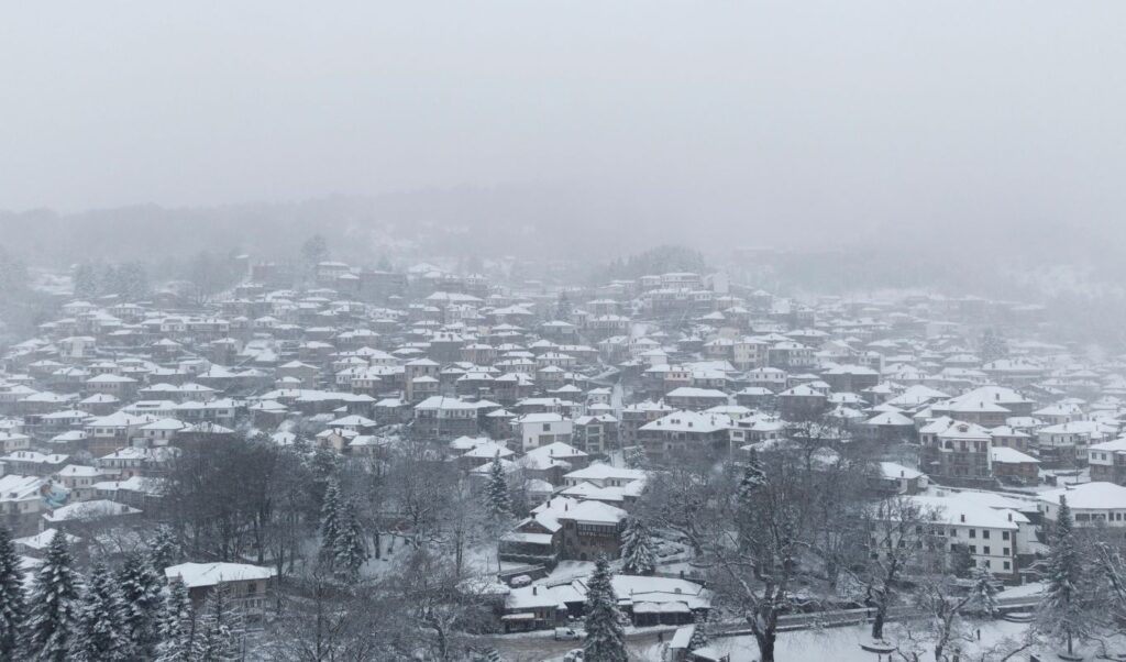
Dense snowfall will occur in all mountainous and semi-mountainous areas, while snow is expected to fall even inside cities of Thessaly and Macedonia. Florina, Edessa, Veria, suburbs of Thessaloniki, Karditsa, Trikala, will see heavy snow with possible blockages in the most mountainous areas and problems on the country’s road network from the snow.
Attica will be affected by the severe weather with heavy rains and storms.
The 7 areas where large amounts of water will fall
The deep barometric low moving from the Gulf of Sirte northeast will bring significant weather deterioration, with heavy rains and storms, as well as snowfall even at low altitudes, on Wednesday, reports meteo.gr.
According to the forecast data from the National Observatory of Athens / Meteo.gr, during Wednesday 21/01, rains and storms will be locally heavy from noon in Eastern and Southern Peloponnese, from afternoon in Eastern Central Greece (including Attica), Thessaly, Evia, the Sporades and from evening in the Cyclades.
In Attica prefecture and the city of Athens, rains are forecast from early morning, which will intensify from afternoon and heavy rains and storms will occur.
According to the rainfall episode categorization (RPI), which is applied by the Meteo unit of the National Observatory of Athens, the rainfall episode on Wednesday 21/01, is classified in Category 5 (Extreme).
Additionally, for the severe weather, the following should be taken into account:
– Heavy snowfall in mountainous and semi-mountainous areas of mainland Greece and the North Aegean, but also in areas with lower altitude in Western and Central Macedonia, Thessaly and temporarily Eastern Macedonia and Thrace.
– Large amounts of water expected mainly in Eastern and Southern Peloponnese, Central and Eastern Central Greece, Evia, Eastern and Southern Thessaly,
– Stormy winds in the west and south,
In the maps below, the estimated rainfall heights are presented in two time snapshots of Wednesday as well as the total snow height until Wednesday evening 21/01.

Map 1: Forecast map of rainfall distribution for Wednesday 21/01 for the three-hour period 17:00 – 20:00.

Map 2: Forecast map of rainfall distribution for Wednesday 21/01 for the three-hour period 20:00 – 23:00.
Weather improvement is expected from Thursday (22.01.2026), with limitation of phenomena, mainly in the Eastern Aegean and Dodecanese. There too, winds will gradually weaken and days with milder weather will follow, unstable but not extreme.
Europe prefers respect, not bullies, says Macron. The French president denounced the imposition of “new, unacceptable tariffs” by the US, emphasizing that the situation becomes even more serious when these tariffs “are used as a means of pressure”. As he characteristically stated, “the United States demands maximum concessions”, within the framework of a trade strategy that, according to him, is directly aimed against European interests.
Civil Protection for severe weather: Emergency meeting, 5 regions on “code red” – Complete announcement for the cold wave
With the topic of the session being the severe weather from tomorrow Wednesday until Thursday noon, with heavy rains and storms, locally intense snowfall, and locally stormy winds, the General Secretary of Civil Protection, Nikos Papaeustathiou, convened the Risk Assessment Committee in the presence of Minister of Climate Crisis and Civil Protection Yannis Kefalogiannis, today Tuesday.
The announcement for the severe weather
a. Tomorrow Wednesday particularly heavy rains and storms are expected in Eastern and Southern Peloponnese (mainly in Messinia, Laconia, Argolida and Corinthia), eastern Central Greece, Evia, Attica, eastern Thessaly and the Sporades and from the evening of the same day, until Thursday noon, in the islands of the Northern and eastern Aegean as well as the Dodecanese.
b. Snowfall is expected on Wednesday in the mountainous – semi-mountainous areas of mainland Greece and will be particularly dense and at low altitudes in western Thessaly and western Macedonia (mainly Trikala, Karditsa and Evrytania).
c. Stormy winds 8 to 9 Beaufort will blow locally, until Wednesday noon in the northern Ionian, and until Thursday morning in the southern and central Aegean.
The National Coordination Center for Operations and Crisis Management (E.S.K.E.DI.K.) is already in communication with the first and second level local authorities, as well as with all involved agencies in order to have complete information about the impending weather phenomena so that they can be put into operational action if required.
The General Secretariat of Civil Protection after the Emergency Bulletin of Dangerous Weather Phenomena (EDEIKF), issued by the National Meteorological Service (EMY) and the session of the Risk Assessment Committee, put on mobilization status (Red Code) from Wednesday until Thursday the Regions:
– Attica
– Peloponnese
– Central Greece
– Thessaly
– Western Macedonia


