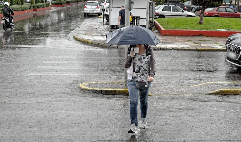
The severe weather system has begun its advance across the country since Wednesday evening, October 1st, with meteorologists warning of dangerous weather phenomena that will affect large parts of Greece over Thursday-Friday. Specifically, heavy rain and thunderstorms will hit almost the entire country, with Attica expected to experience more intense phenomena from Thursday afternoon, October 2nd, onwards. Rain has already started in many areas of Athens, causing increased traffic on most major road networks.
As meteorologist George Tsatrafyllias emphasizes, “the cold front will pass through Attica shortly.” His detailed analysis follows:
“The cold front will pass through Attica shortly!”
Good morning!
🎯The storm is currently hitting the southern Peloponnese and the cold front is expected to pass through Attica by noon. Minor problems may occur in the Athens basin due to the intensity of the phenomena rather than large volumes of water.
👉In the rest of the country, there is a real risk of flooding episodes:
📌From noon until Friday morning north of Larissa, in Chalkidiki, Pieria and Imathia.
📌From tonight until Friday afternoon, October 3rd, in eastern Macedonia and Thrace, the northern and eastern Aegean islands and the Dodecanese.
Storm warning: Emergency messages from 112 to Ionian and Western Greece
Shortly after 21:30 on Wednesday, a warning message was sent via 112 to residents of the Ionian Islands Region, alerting them to heavy rainfall and thunderstorms from evening hours until Thursday noon.
⚠️ Ενεργοποίηση 1️⃣1️⃣2️⃣
🆘 Προειδοποίηση για ισχυρές βροχοπτώσεις και καταιγίδες στην Περιφέρεια Ιονίων Νήσων από τις βραδινές ώρες της 01/10/2025 έως τις μεσημβρινές ώρες της 02/10/2025.
‼️ Προσοχή στις μετακινήσεις σας.
‼️ Ακολουθείτε τις οδηγίες των Αρχών.…— 112 Greece (@112Greece) October 1, 2025
A similar message was sent minutes later to residents of Achaia, Ilia and Messinia prefectures for dangerous weather phenomena from Thursday morning until Thursday afternoon, October 2nd. The message stated: “Warning for heavy rainfall and thunderstorms in Achaia, Ilia, Messinia areas from Thursday morning 02/10/2025 until afternoon hours of the same day. Be careful with your movements. Follow the authorities’ instructions.”
⚠️ Ενεργοποίηση 1️⃣1️⃣2️⃣
🆘 Προειδοποίηση για ισχυρές βροχοπτώσεις και καταιγίδες στις περιοχές Αχαΐα, Ηλεία, Μεσσηνία από τις πρωινές ώρες της 02/10/2025 έως τις απογευματινές ώρες της 02/10/2025.
‼️ Προσοχή στις μετακινήσεις σας.
‼️ Ακολουθείτε τις…— 112 Greece (@112Greece) October 1, 2025
Additionally, on Thursday morning October 2nd, a 112 message was sent to Laconia residents warning of heavy rainfall and thunderstorms from early morning hours until afternoon hours of 02/10/2025.
⚠️ Ενεργοποίηση 1️⃣1️⃣2️⃣
🆘 Προειδοποίηση για ισχυρές βροχοπτώσεις και καταιγίδες στην περιοχή της Λακωνίας από τις πρωινές ώρες της 02/10/2025 έως τις απογευματινές ώρες της 02/10/2025.
‼️ Προσοχή στις μετακινήσεις σας.
‼️ Ακολουθείτε τις οδηγίες των Αρχών.ℹ️…
— 112 Greece (@112Greece) October 2, 2025
Zakynthos: Schools closed due to severe weather
Zakynthos is expected to be at the center of the new storm wave, which will last until Friday evening. Main weather characteristics will include heavy rain, thunderstorms and possible hailstorms.
Based on the emergency bulletin for dangerous weather phenomena from the National Meteorological Service, Zakynthos Mayor George Stasinopoulos announced that all island schools will remain closed on Thursday, October 2nd, as a precautionary measure.
Rescue operation in Corfu
Heavy rainfall is already affecting Corfu, with the Fire Service intervening to rescue a family of British tourists. Their vehicle became trapped in mud on a dirt road in the Akrotiri Drastis area in the northern part of the island. Firefighters managed to safely transport them to the main road of Peroulades. All are in good health.
New emergency weather bulletin from National Meteorological Service – Snow in northern mountains
The National Meteorological Service continues issuing warnings, with a new emergency bulletin reporting heavy rain, thunderstorms, local hailstorms and snowfall in the mountains of northern Greece. The phenomena will persist throughout Thursday and weaken by Friday noon.
The detailed forecast follows:
Severe weather with heavy rain, thunderstorms and local hailstorms are forecast for the country during Thursday (2-10-25) – Friday (3-10-25). This significant weather deterioration will be caused by cold air masses in the upper atmosphere of central Europe that will reach our region via the Adriatic. It’s emphasized that most areas of Greece will be affected by intense phenomena.
More specifically, heavy rain, thunderstorms and local hailstorms are forecast:
A. Thursday (2-10-25)
a. From early morning until afternoon in the Ionian islands
b. From dawn until afternoon in Epirus, western Macedonia, western Central Greece and western and southern Peloponnese
c. From late morning hours in central Macedonia
d. From noon and intermittently until evening in Thessaly, central and eastern Central Greece (including Attica), the rest of Peloponnese, western Crete, Evia and Sporades
e. From evening hours in the Eastern Aegean islands and eastern Macedonia
f. From late night in Thrace
B. Friday (3-10-25)
a. From early morning until afternoon in the Dodecanese
b. Until noon in eastern Macedonia, Thrace and Eastern Aegean islands
c. Until morning hours in central Macedonia
Intense and dangerous phenomena in the following areas:
a. In the Ionian islands (mainly Zakynthos, Kefalonia) and western and southern Peloponnese on Thursday until early afternoon
b. In central Macedonia from Thursday afternoon until Friday morning
c. In eastern Macedonia, Thrace and Eastern Aegean islands on Friday until noon
d. In the Dodecanese on Friday from early morning until afternoon
Meteorologist George Tsatrafyllias sounds the alarm for the approaching severe weather through his Facebook post. The Alpha TV and Weather2GO.gr meteorologist states that the storm will bring rain, thunderstorms and local hailstorms to many areas, characterizing it as “deceptive and dangerous.”
George Tsatrafyllias’s post about the storm:
Deceptive and dangerous severe weather due to warm sea temperatures…
Its main characteristics:
Heavy rain, thunderstorms and local hailstorms (above the P-shaped system) on Thursday from early morning in western areas and gradually in northern regions. On Friday Macedonia-Thrace, northern and eastern Aegean and Dodecanese. We expect phenomena in most areas.
Gale-force winds mainly in Ionian and southern Aegean seas.
Temperature drop up to 8 degrees and light snow in northern mountains.
Attica: Passage of strong thunderstorms on Thursday 2/10 during midday hours.
Note: Sea temperature plays a significant role in storm development (low pressure systems) and can affect both intensity and trajectory.
Specifically:
Enhancement (deepening low pressure):
When the sea is warm, more moisture evaporates → feeding the system with latent heat as water vapor condenses into clouds/rain. This can lead to faster cloud development, stronger rainfall and deepening low pressure.
Movement modification:
Atmospheric heating near the surface can change pressure and temperature distribution, affecting winds and consequently the low’s trajectory. A warm sea background can pull the system more south or east than expected.
“The main characteristics of the severe weather are maintained in new model