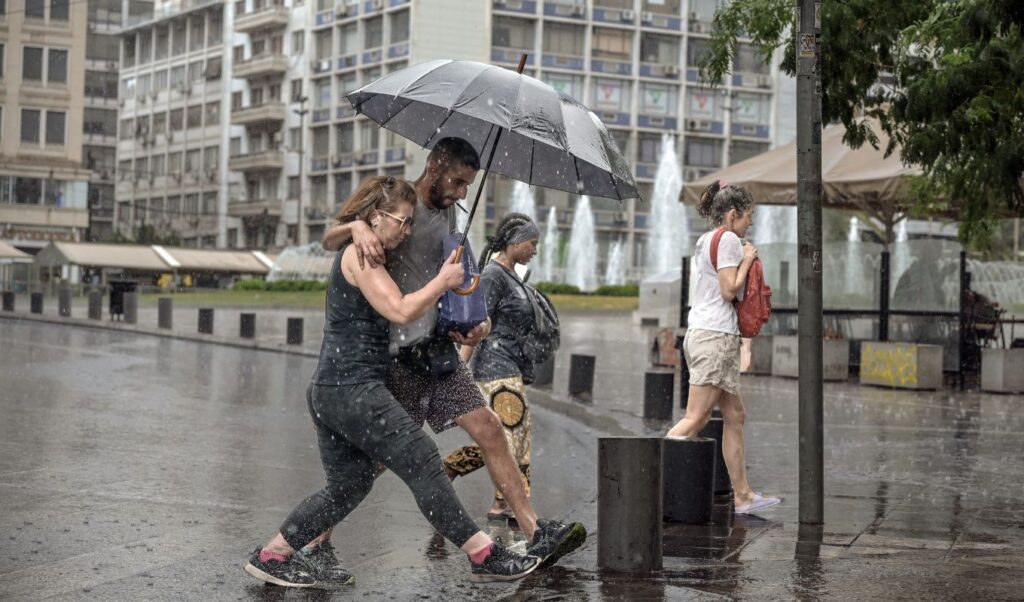
With the phrase “first storms then 40s,” Giorgos Tsatrafyllias in his weather forecast posted on social media, warns both about the severe weather phenomena that will occur on Saturday and the heatwave with which September will greet us.
On one hand mild temperatures, lightning and storms, and on the other a heatwave with temperatures up to 40 degrees. These characteristics make up the weather profile at the end of August and the beginning of September.
According to the meteorologist, the strong meltemi winds will subside during the weekend and from Saturday the temperature will start to rise, reaching 37 degrees in Thessaly, Fthiotida, Boeotia and central Macedonia.
While the country begins to “melt” from heat, on the same day storms, hailstorms and lightning in the northern Ionian and Epirus will locally drop the temperature.
Regarding the 40-degree temperatures, from next Tuesday and Wednesday the temperature will affect the vulnerable areas, namely eastern and northern Greece.
“Heat in the first week of September confirmed”
Giorgos Tsatrafyllias’ detailed post:
First storms and then 40s…. Good afternoon! The meltemi winds are weakening from today with the result that the temperature will rise during the weekend. Particularly on Saturday, the mercury will hover around 37 degrees in Thessaly, Fthiotida, Boeotia and central Macedonia. The wind (libas) will also help.
Great attention is needed on Saturday for storms in the afternoon-evening hours in the northern Ionian and Epirus as they may be accompanied by hail and intense lightning activity. Also, the heat in the first week of September appears to be confirmed. On Tuesday and Wednesday 2-3/9/25 we will move to levels close to 40 in heat-vulnerable areas in eastern and northern Greece. I should emphasize that at this moment there is a divergence in the main forecasting tools about how the warm air mass will ultimately move over our area. We need to wait a bit to assess the duration and intensity of the heat.
Weather on Saturday 30-08-2025
Initially generally clear weather throughout the country, but from noon in the northern Ionian and gradually in Epirus and western Macedonia clouds will develop and rain and sporadic storms will occur, which may locally from the afternoon in the areas of Corfu, Paxi and Epirus be strong.
Winds will blow from southern directions 3 to 5, locally from noon in the northern Ionian 6 Beaufort and only in the Dodecanese will blow northwest 3 to 5 Beaufort.
Temperature will not show significant change and will reach 33 to 35 degrees on the mainland, locally in the eastern areas 36 and in the island country 30 to 32 degrees Celsius.
Attica
Weather: Generally clear.
Winds: Variable 2 to 3 and from noon south southeast 3 to 4 Beaufort.
Temperature: From 21 to 33 degrees Celsius.
Thessaloniki
Weather: Generally clear with few clouds from the afternoon hours.
Winds: South southeast 2 to 4 Beaufort.
Temperature: From 19 to 32 degrees Celsius.
Macedonia – Thrace
Weather: Generally clear. After noon in western Macedonia clouds will develop and rain and sporadic storms will occur.
Winds: Southern directions 2 to 4 Beaufort.
Temperature: From 17 to 34 degrees Celsius. In western Macedonia it will be 3 to 4 degrees lower.
Ionian Islands – Epirus – Western Central Greece – Western Peloponnese
Weather: Initially generally clear. From noon in the northern Ionian and gradually in Epirus clouds with rain and sporadic storms that may from the afternoon locally in the Corfu-Paxi area and Epirus be strong.
Winds: In the northern Ionian from southern directions 4 to 5 and from noon 6 Beaufort. In other areas southwest 3 to 4 Beaufort.
Temperature: From 19 to 33 degrees Celsius. In Epirus and the Ionian it will be 2 to 3 degrees lower.
Thessaly – Eastern Central Greece – Evia – Eastern Peloponnese
Weather: Generally clear. From the afternoon hours in the western parts of Thessaly clouds will develop and possibly a few rains will occur.
Winds: West southwest 3 to 4 Beaufort and in the eastern parts south southeast 4 to 5 Beaufort.
Temperature: From 18 to 36 degrees Celsius.
Cyclades – Crete
Weather: Generally clear.
Winds: West southwest 3 to 4 Beaufort.
Temperature: From 22 to 30 to 32 degrees Celsius.
Eastern Aegean Islands – Dodecanese
Weather: Generally clear.
Winds: Southwest 3 to 4 and in the Dodecanese northwest up to 5 Beaufort.
Temperature: From 22 to 32 degrees Celsius.
Forecast for the coming days
Weather on Sunday 31-08-2025
In western and northern Greece clouds locally increased with local rain and sporadic storms. The weather will gradually improve, from the morning hours in the west, from early afternoon in Macedonia and from the evening in Thrace.
In the rest of the country generally clear weather with temporary clouds in Thessaly in the morning.
Winds will blow south southwest 3 to 5, locally in the southern Aegean 6 and from noon in the west northwest 4 to 5 Beaufort.
Temperature will drop in the west and north. It will reach 30 to 32 degrees in the west and northern mainland and Ionian islands, 34 to 35 degrees in the other mainland areas and 32 to 33 degrees Celsius in the rest of the island country.
Weather on Monday 01-09-2025
Generally clear weather with local clouds in Macedonia and Thrace during midday – afternoon hours.
Winds will blow west northwest 3 to 5 and in the southern Aegean locally up to 6 Beaufort.
Temperature will not show significant change.
Weather on Tuesday 02-09-2025
Generally clear weather.
Winds will blow northwest 3 to 5 and in the eastern Aegean locally up to 6 Beaufort.
Temperature will show a small rise.
Weather on Wednesday 03-09-2025
Generally clear weather with few clouds from the afternoon in the north.
Winds will blow from northern directions 3 to 5 and in the Aegean locally up to 6 Beaufort.
Temperature will show a small further rise.


