Weather instability and afternoon storms are expected to continue today in several areas of the country, with emphasis on northern Greece, according to meteorologist and research director of the National Observatory of Athens, Kostas Lagouvardos. As he notes, today’s instability will be more limited, mainly in the central and southern mainland areas. Local rain or storms may even occur in the northern suburbs of Athens.
Read: Weather: Instability and “autumn landscape” on Tuesday – New heat wave days coming from Wednesday
From Wednesday onwards, the phenomena will subside in most areas of the country, while temperatures will begin to rise gradually, reaching higher levels towards the end of the week.
Today’s weather
Clouds with rain and thunderstorms are forecast for Central and Eastern Macedonia, Thrace and Thessaly, and at noon and afternoon in the rest of the mainland, mainly mountainous areas. There is a possibility of hail in the mountainous areas of Central and Northern Greece.
Temperatures in Western Macedonia will range from 17 to 29 degrees Celsius, in the rest of Macedonia and Thrace from 20 to 34, in Thessaly from 21 to 36, in Epirus from 18 to 30, in Central Greece and the Peloponnese from 19 to 35, in the Ionian islands from 20 to 32, in the North and East Aegean islands from 19 to 35, in the Cyclades and Dodecanese from 18 to 33, and in Crete from 18 to 32 degrees Celsius.
Winds will blow from northwestern directions 2 to 4 Beaufort, in the southern seas and the Aegean locally 5 Beaufort.
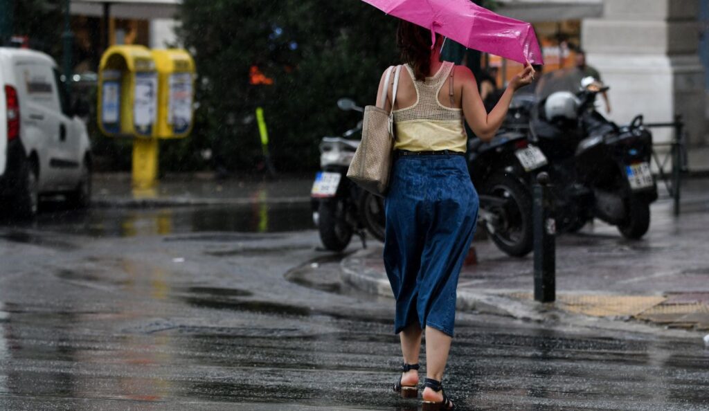
In Athens the weather will be clear, but at noon and afternoon clouds will develop and local rain and possibly thunderstorms will occur in the western and northern parts of the region. Winds will be variable 2 to 4 Beaufort. Temperature will range from 22 to 35 degrees.
In Thessaloniki clouds with local rain and possibly thunderstorms are forecast in the western and northern areas. Winds will blow from northwestern and after noon from southeastern directions 2 to 4 Beaufort. Temperature will range from 22 to 34 degrees.
Weather on Wednesday, August 20
Generally clear weather. Local clouds with possibility of showers during midday-afternoon hours in eastern Central Greece, Thessaly, central and eastern Macedonia and Thrace.
Winds will blow in the west from west-northwest 3 to 5 and in the east from northern directions with the same intensity, locally 6 Beaufort in the eastern Aegean.
Temperature will not show significant change and will reach 30 to 32 degrees in most areas, locally 33 to 34 in the central mainland and 28 to 30 degrees Celsius in the Sporades and Cyclades.
Weather on Thursday, August 21
Generally clear weather with few temporary clouds in the north during midday-afternoon hours.
Winds will blow in the northern Ionian from southern directions 3 to 4 Beaufort and in the rest from northern directions 4 to 5 and in the Aegean locally up to 6 Beaufort.
Temperature will rise.
Weather on Friday, August 22
In the northern Ionian and northwestern mainland, increased clouds are forecast in the morning hours with possibility of local rain until noon and gradually clear. In the rest of the country generally clear weather with few temporary clouds in the north during midday-afternoon hours.
Winds will blow in the northern Ionian and northwestern Aegean from southern directions 3 to 4 Beaufort. In the rest from northern directions 4 to 5 and in the southern Aegean locally up to 6 Beaufort.
Temperature will show a small further rise.
Weather on Saturday, August 23
Generally clear weather with few temporary clouds in the central and northern mainland during midday-afternoon hours. In the morning hours in the west, visibility will be limited and local fog will occur.
Winds will blow west-northwest 3 to 5 and in the southern Aegean locally 6 Beaufort.
Temperature will show a small drop.