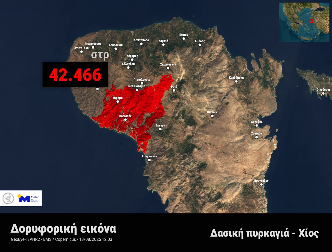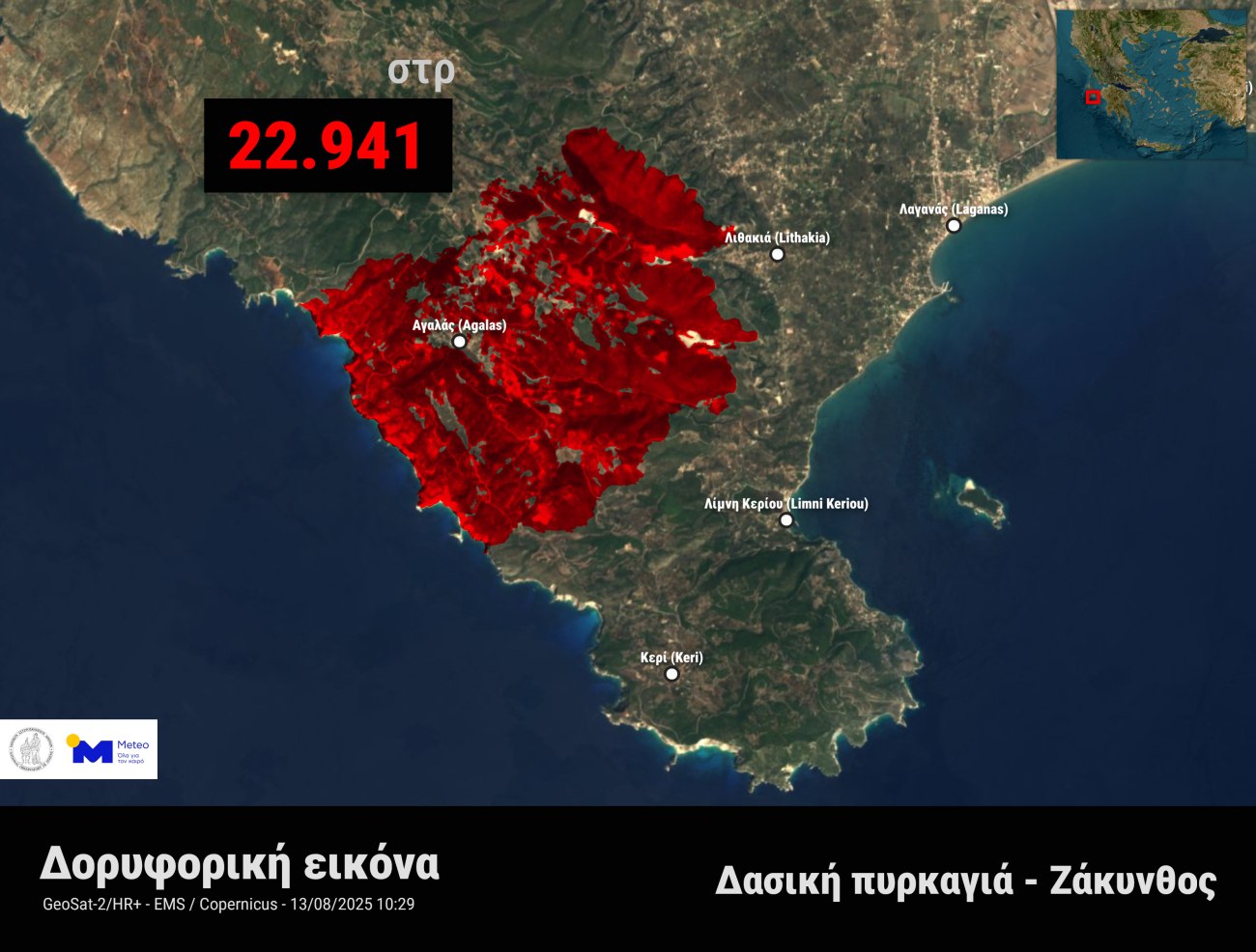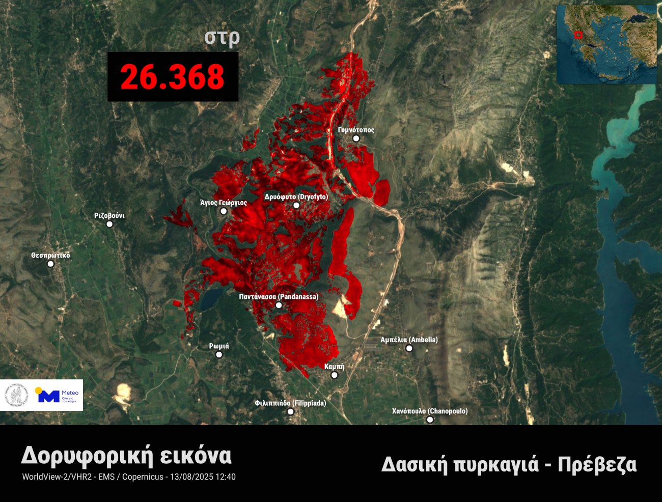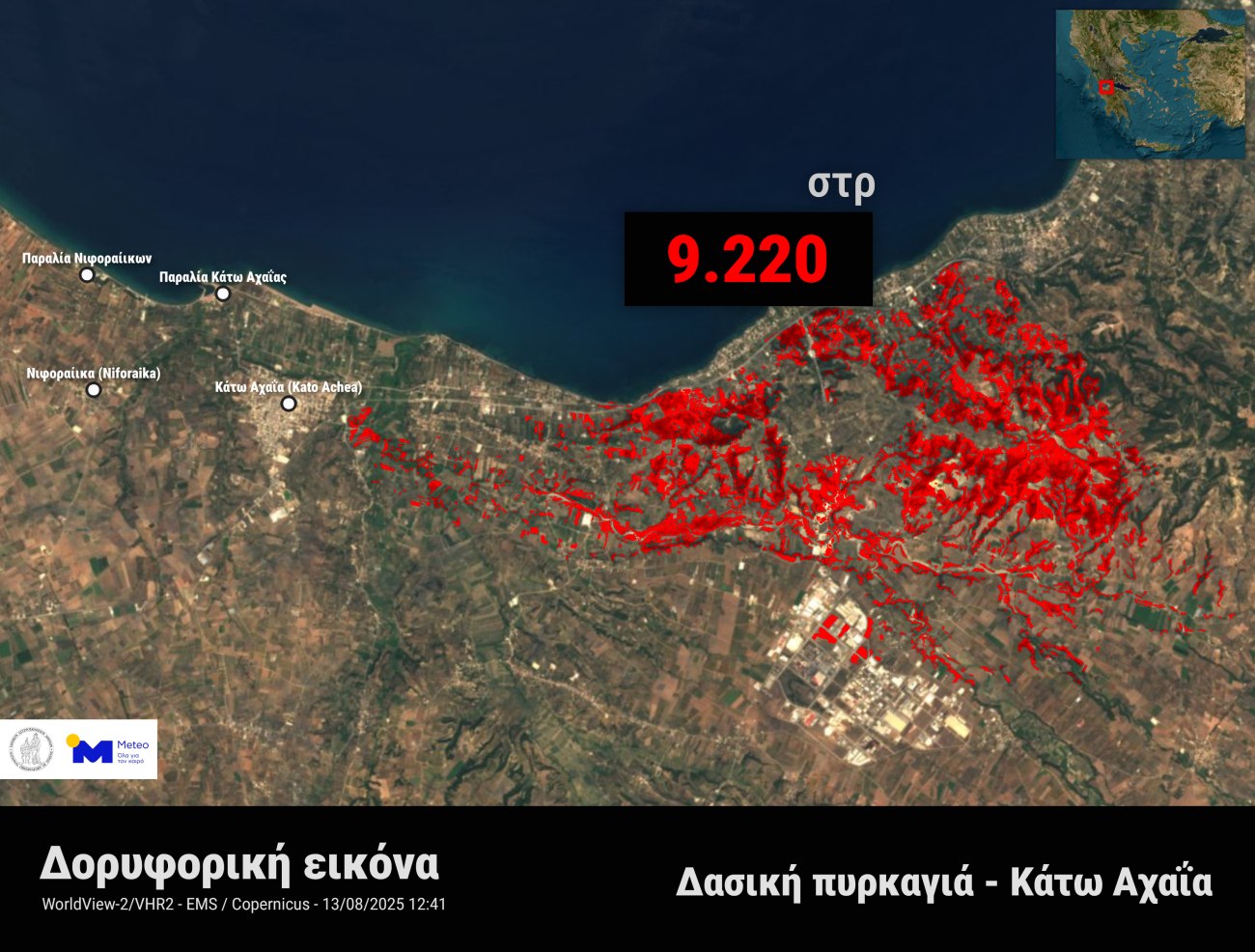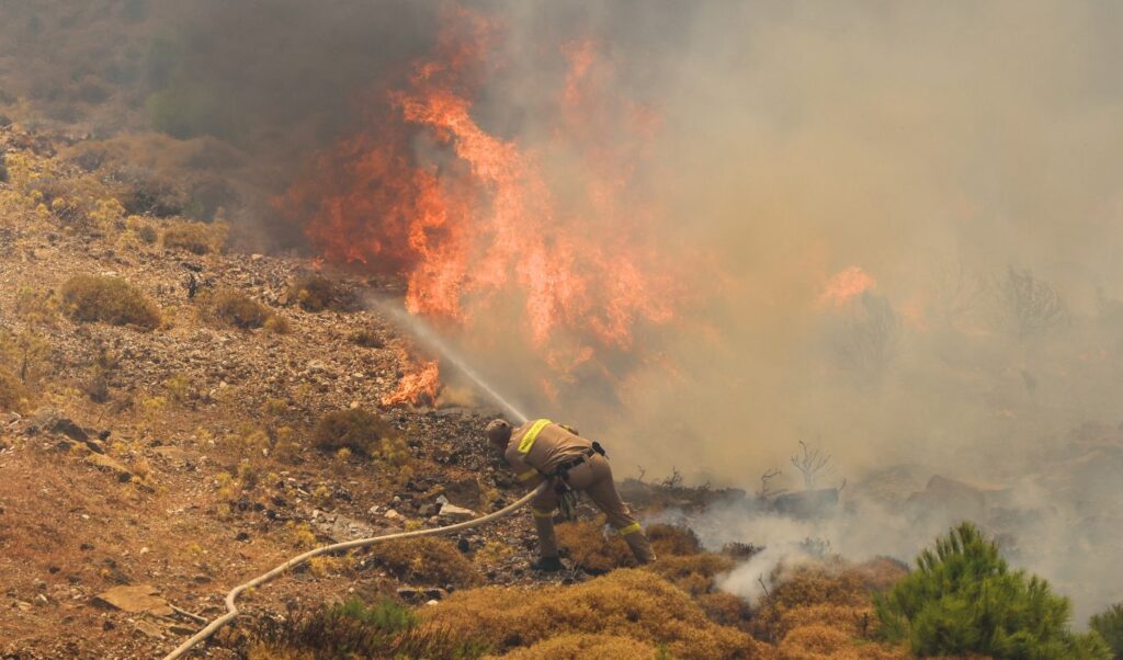
High-resolution satellites passed over the areas affected by the major fires that burned large expanses in many parts of the country yesterday afternoon. According to satellite data processed by meteo.gr / National Observatory of Athens, the burned areas from the devastating agricultural and forest wildfires in Chios, Zakynthos, Preveza and Western Achaia are estimated to exceed 100,000 acres.
Wildfires in Greece: Maps showing the burned areas
Specifically, analysis of satellite data from the European Copernicus EMS mechanism, up to 12:40 PM on Wednesday (13/08) showed that the following areas were burned:
- 42,466 acres in Chios,
- 22,941 acres in Zakynthos,
- 26,368 acres in Preveza, and
- 9,220 acres in Western Achaia