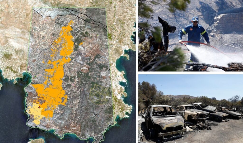
The affected area from the wildfire that broke out on Friday (8/8) in Keratea and spread to southeastern Attica regions amounts to 15,808 acres, with a 76-year-old man losing his life and extensive damage to homes and properties.
Read: Arrests of power company employees over Keratea fire – Executive still sought
Fire service forces and volunteers during the firefighting operation, which due to very strong winds rapidly escalated to massive proportions, made superhuman efforts to save and protect the Sounion National Forest, successfully containing the fire and stopping it before it reached the protected area.
Keratea fire: Satellite image reveals scale of destruction
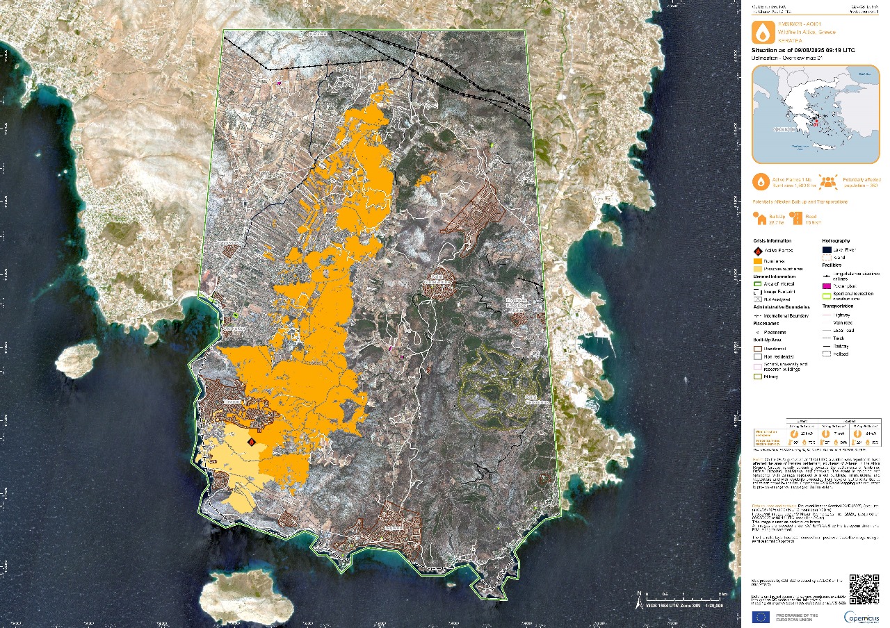
According to the Copernicus service analysis of the burned area, no forests or woodland areas were burned, while the majority of the affected area consists of grassland and shrubland.
Based on satellite imagery taken yesterday at 12:19 following activation of the Copernicus Service, it is estimated that of the 15,808 acres burned, 11,267 acres are grassland and shrubland areas. The following image showing the affected area also displays in yellow the fire that occurred in the past on 26/6/2025 in Thymari.
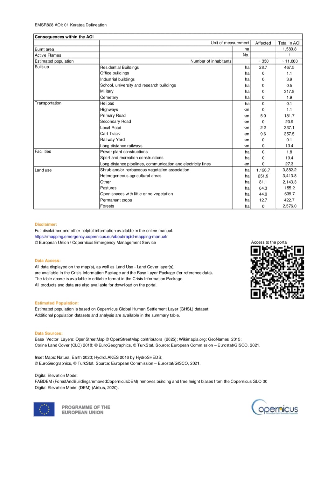
Breakdown of burned areas follows:
Total area 15,808 acres. Of which
- 11,267 acres grassland and shrubland
- 2,519 acres mixed/agricultural
- 811 acres other land uses
- 643 acres pastureland
- 440 acres open spaces with minimal vegetation
- 127 acres crops
- 0 acres forests/woodland areas
Below is the attached table detailing the burned areas.
Source: ΑΠΕ-ΜΠΕ