The “invasion” of severe weather system “Erminio” has begun just hours ago, with heavy rains and thunderstorms already recorded in many parts of the country. Meteorologist Elina Karetsou spoke on Parapolitika 90.1 and the “First Morning” show with journalist Alexandros Klossa, providing the latest data on the severe weather affecting the country. Ms. Karetsou described it as a particularly powerful – and potentially dangerous – weather system, noting that the areas currently being affected are mainly the western, central and southern regions. Ms. Karetsou clarified that “it’s still too early to talk about particularly intense phenomena, but they will intensify later on.”
Key characteristics of storm “Erminio”
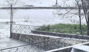
Explaining the key characteristics of storm “Erminio,” Ms. Karetsou described heavy rains, thunderstorms, localized hailstorms and significant total rainfall amounts. Essentially, the meteorologist stated that “it will rain in all regions of the country intermittently and throughout the entire day,” while weather phenomena will be particularly intense in many areas. She added that today (01/04) severe weather phenomena are expected in the Ionian islands and southwestern Peloponnese. She emphasized that rainfall is already occurring in the Ionian Sea, and regarding areas requiring caution, she mentioned the following: Peloponnese, Attica, Epirus, Thessaly and Sporades. She also referenced Pieria, northern parts of the Cyclades, the eastern Aegean and the Dodecanese. “We expect quite a lot of water to fall in a short period of time,” she said characteristically.
In addition to the above, Ms. Karetsou mentioned that snowfall will occur in mainland mountainous areas, which will be denser in the mountains of Epirus and Western Macedonia, without it being expected to create problems. Also, African dust transport will occur in the southern and eastern parts of the country, where “mud rains” will be recorded.
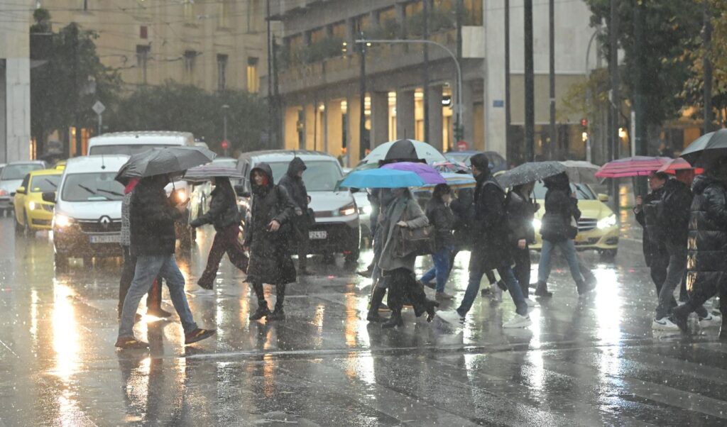
Severe weather phenomena in Attica after noon
Another characteristic of storm “Erminio,” according to Elina Karetsou, is the stormy winds that will blow at 6 to 8 Beaufort in the Aegean Sea. Special attention is required in the eastern Aegean where winds will reach 9 Beaufort. Regarding temperature, Ms. Karetsou mentioned that there will be a slight drop, mainly in the northern and central regions, while Crete will record the highest temperature values. Regarding when the severe weather will be felt in Attica, Ms. Karetsou emphasized that from noon onwards there will be heavy rains and thunderstorms that will last until late at night. She also said that strong winds will occur in Attica as well, however the temperature will rise.
How the severe weather will move tomorrow (02/04)
Additionally, Ms. Karetsou emphasized that Thursday (02/04) will also be particularly significant, however the phenomena will not be as strong as today, but in any case, “the instability will continue tomorrow as well.” “Tomorrow we expect stronger phenomena in western and southern Peloponnese, eastern Thessaly, the Sporades, central Macedonia. However, the areas that will be affected tomorrow by storm ‘Erminio’ will be significantly fewer than today. “The temperature will be at the same levels, while there will be a slight drop in the northern and central regions, as the remaining areas will be at the same levels,” said Ms. Karetsou.
“We need to be careful”
Finally, Ms. Karetsou emphasized that “we need to be careful because our country unfortunately now floods with very few millimeters of rain, so when we expect a larger volume of water, things become more difficult,” urging citizens to avoid unnecessary travel.