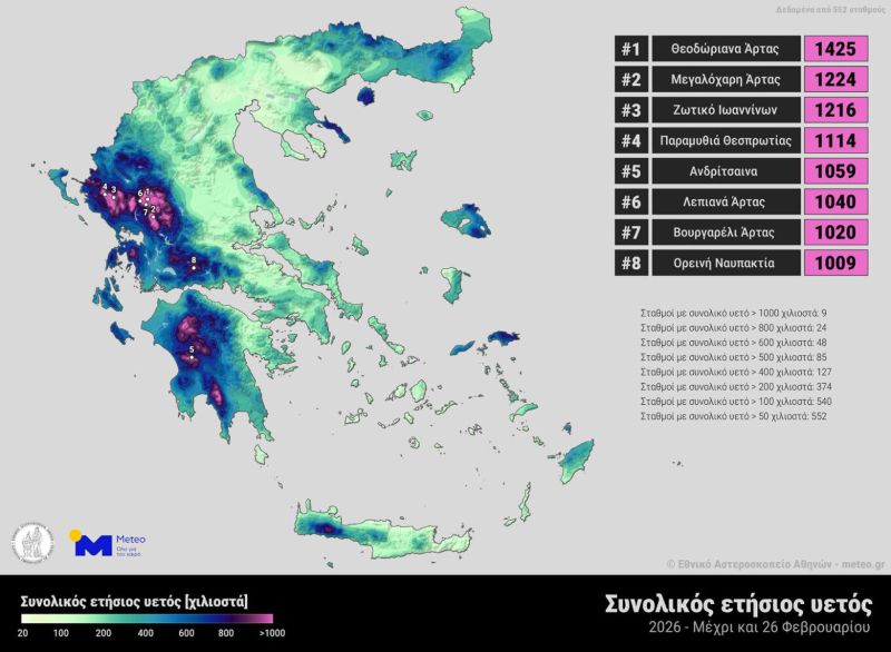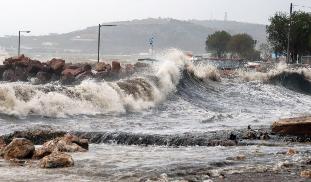
Winter officially ends this Saturday and the desire for spring’s arrival and sunny weather patterns is captured in photographers’ shots, like those from Eurokinissi agency in the Argolic plain, featured below. However, the 18 severe weather waves that hit Greece, through which major destruction was caused, while five people lost their lives after being swept away by torrents, strong winds and sea turbulence in four of these events, from November 2025 to February 2026, are almost unprecedented. The National Observatory of Athens attempted to analyze what occurred as the country was “visited” by waves of cold and water at regular and irregular intervals. Many areas still suffer from the consequences, as buildings collapsed, landslides occurred, soils and slopes gave way, settlements were cut off and evacuated, and homes were “pushed” to the edge of cliffs. Thus, the social and economic impacts were clear. According to meteo data, significant rainfall amounts were recorded in parts of southern and western Europe.
Read: Severe weather: Epirus and Thrace “drowned” – Map showing areas with heaviest rainfall


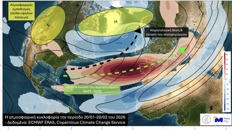
Weather: High in the atmosphere
The 18 severe weather waves that occurred from early November 2025 to late February 2026 have their explanation. The National Observatory of Athens emphasizes that it wasn’t “bad luck,” as the answer lies high up in the atmosphere. There, where the position of the jet stream is located, as well as its intensity. A jet stream is initially a strong air current at approximately 10-11 kilometers above Earth’s surface, moving from west to east. It’s located in areas where there’s an intense temperature difference between two air masses (horizontal thermal gradient), while the jet stream’s movement determines the formation and movement of pressure systems.
Specifically, the period from January 20 to February 20, 2026 was characterized by a very active (stronger than normal) and zonal (oriented from west to east) jet stream that became “trapped” at very southern latitudes (unusually southern compared to its average climatological position). This resulted in successive low-pressure systems following similar trajectories/paths from the southernmost parts of the North Atlantic toward Southern and Western Europe, reaching our country. This movement of successive low-pressure systems resulted in transporting significant amounts of moisture even from the Caribbean Sea and the Atlantic toward Southern and Western Europe, causing successive and significant rainfall in the same areas with characteristic persistence.