
Thursday’s sunshine on February 19 seemed to herald the arrival of spring, however a cold front expected to cross the country from west to east on Friday, February 20 punishes any haste regarding the weather. Long-duration and intermittently intense rainfall, thunderstorms and increasing wind strength will be characteristic features across many parts of the country. Maps from the National Observatory of Athens reveal the truth of the matter, as throughout the day various regions will face rainfall and thunderstorms – something not at all favorable for those areas already dealing with ground subsidence and structurally compromised buildings.
Weather: What the maps show
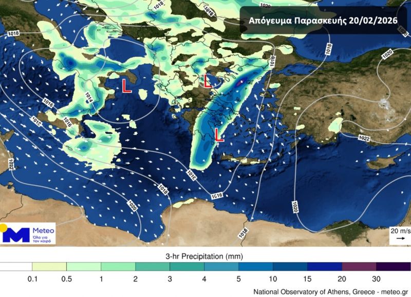
Three maps from the National Observatory of Athens (meteo) show the front’s trajectory. Early Friday morning, February 20, it appears that rain and thunderstorms will mainly affect the Ionian islands, Epirus and western Greece generally, while the rest of the country will experience increased cloud cover with local showers. This is shown in the first map below. The second map immediately following shows the storm’s progression at midday and afternoon, as the phenomena will extend to cover most mainland areas, as well as the northern and central Aegean islands. Severe thunderstorms are expected in coastal areas of the Peloponnese, accompanied locally by stormy wind gusts, hail and increased probability of tornado formation.

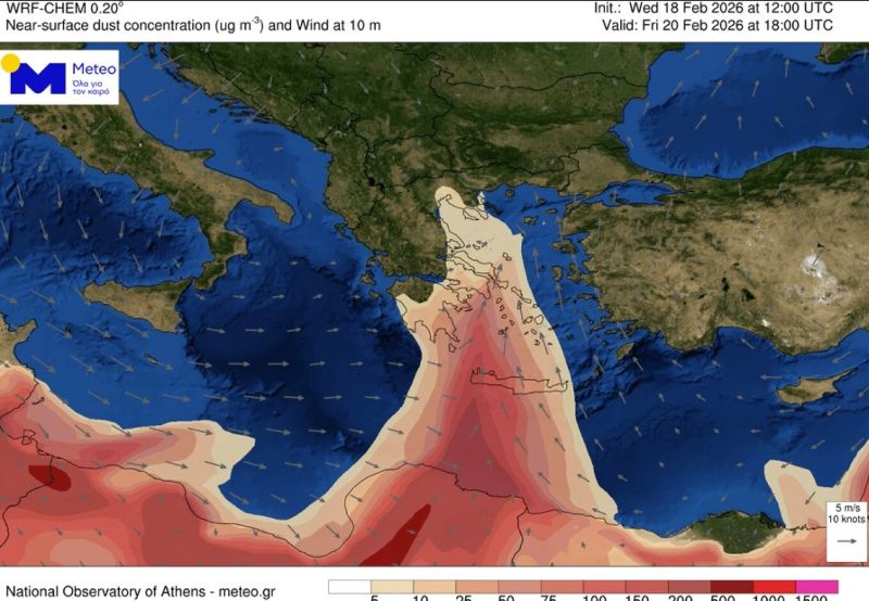
Strong southerly winds are additionally expected in the afternoon in Attica, along with rainfall. Indeed, it appears that the ongoing transport of dust from Africa may potentially bring muddy rain to southern Greece, including Attica.
Good… evening
By Friday evening, weather improvement is expected in mainland areas. However, not in eastern Macedonia and Thrace, as rainfall will prove persistent at least until Saturday morning, February 21. Additionally, in the Aegean islands and Crete heavy rain and thunderstorms will continue until the afternoon hours of the same day, albeit intermittently.