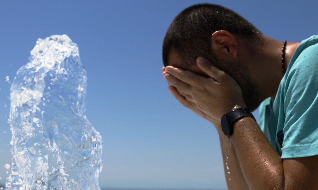
With high temperatures that will reach and exceed 40 degrees Celsius in many areas, the heatwave sweeping the country will continue tomorrow. The atmosphere will be suffocating and almost prohibitive for outdoor activities, especially during midday hours. Competent authorities will be on high alert as the high temperatures create an elevated risk of wildfire outbreaks. Moreover, circulation bans in forested areas will be in effect in many regions of the country.
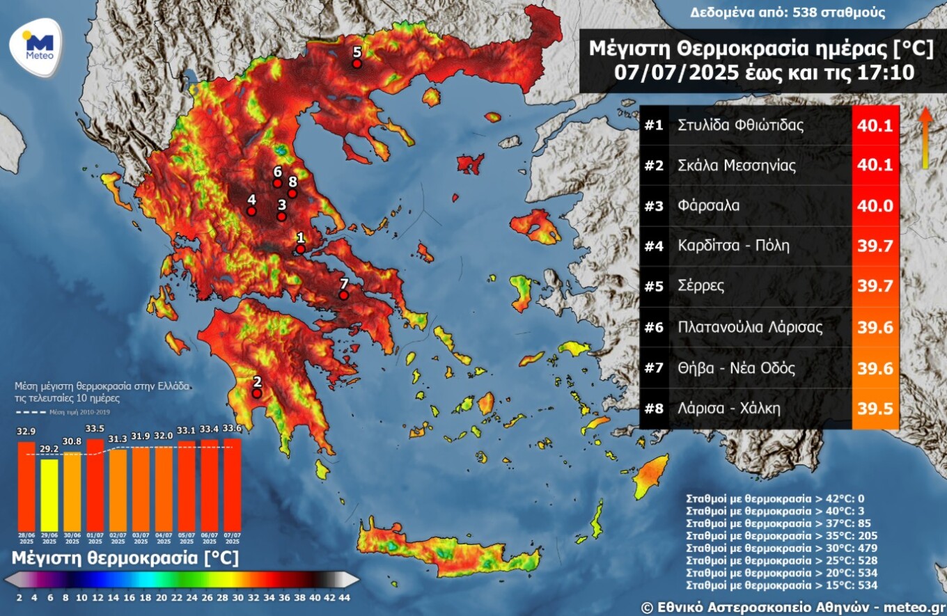
Today, Monday, the thermometer hit 40 degrees, particularly in the eastern continental parts of the country. As shown in the map below, according to the automatic meteorological stations network of the National Observatory of Athens / meteo.gr, 85 meteorological stations in the network recorded maximum temperatures above 37°C.
Detailed weather forecast for Tuesday, according to EMY
Generally clear weather. Temporary cloud formations in central and northern mountainous areas during midday-afternoon hours. Winds will blow from western-northwestern directions at 3-5 Beaufort, gradually reaching locally 6 Beaufort in central and southern areas.
Temperature will show a slight further increase in eastern continental areas and the Aegean, while in the Ionian and western continental areas a small decrease is expected.
MACEDONIA, THRACE
Weather: Generally clear with few local clouds during midday-afternoon hours in mountainous areas.
Winds: Variable 2-4 Beaufort, and in eastern areas during midday and afternoon hours from southern directions with the same intensity.
Temperature: From 22 to 38-39°C, locally in central Macedonia up to 40-41 degrees Celsius. In western Macedonia the minimum will be 2-3 degrees lower.
IONIAN ISLANDS, EPIRUS, WESTERN CENTRAL GREECE, WESTERN PELOPONNESE
Weather: Generally clear. During midday-afternoon hours, few local clouds will develop in the mountains of Epirus and western Central Greece.
Winds: Variable 3-4 Beaufort, and from midday hours from western directions up to 5 Beaufort.
Temperature: From 22 to 36°C, in continental areas up to 38°C, locally 39 degrees Celsius. In the interior of Epirus the minimum will be 2-3 degrees lower.
EASTERN CENTRAL GREECE, EVIA, EASTERN PELOPONNESE
Weather: Generally clear with few local clouds during midday-afternoon hours in continental mountainous areas.
Winds: From western directions 3-5 Beaufort, gradually locally up to 6 Beaufort.
Temperature: From 25 to 39-40°C, locally up to 41 degrees Celsius.
CYCLADES, CRETE
Weather: Clear.
Winds: From western directions 4-5 Beaufort, gradually in western Crete up to 6 Beaufort.
Temperature: From 23 to 33-34°C, in Crete locally up to 35-36 degrees Celsius.
EASTERN AEGEAN ISLANDS – DODECANESE
Weather: Clear.
Winds: In northern areas variable 3-4 Beaufort, temporarily during afternoon hours western-northwestern up to 5 Beaufort. In southern areas western-northwestern 4-5 Beaufort.
Temperature: From 23 to 37-38 degrees Celsius.
THESSALY
Weather: Generally clear with few local clouds during midday-afternoon hours in continental mountainous areas.
Winds: Western 3-4 Beaufort, temporarily during midday-afternoon hours up to 5 Beaufort.
Temperature: From 22 to 40°C, locally up to 41-42 degrees, and in the Sporades up to 33-34 degrees Celsius.
ATTICA
Weather: Clear.
Winds: From western directions 3-5 Beaufort, temporarily during afternoon hours in western areas up to 6 Beaufort.
Temperature: From 25 to 38-39 degrees Celsius, in coastal areas 2-3 degrees lower.
THESSALONIKI
Weather: Generally clear.
Winds: Variable 2-3 Beaufort, temporarily during afternoon hours southern-southeastern up to 4 Beaufort.
Temperature: From 23 to 38 degrees Celsius.