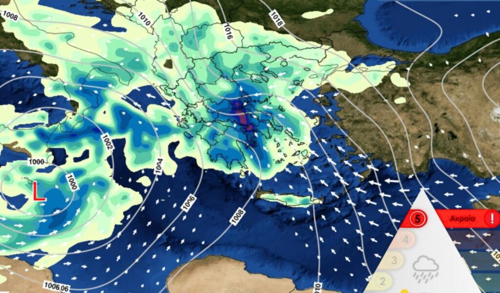
Intense weather deterioration is expected on Wednesday 21/01, as a deep barometric low moving from the Gulf of Sirte towards the northeast will cause heavy rain, storms and snowfall even at low altitudes.
Read: Weather: Cities likely to see snow on Wednesday – Tsatrafullia’s forecast for the new severe weather
According to forecasting data from the National Observatory of Athens / Meteo.gr, rain and storms will develop locally intense from midday in Eastern and Southern Peloponnese, from the afternoon in Eastern Central Greece (including Attica), Thessaly, Euboea and the Sporades, and from evening in the Cyclades.
In Attica and the city of Athens, rain will start from early morning and intensify in the afternoon, with strong storms developing.
The Meteo unit of the National Observatory of Athens classified Wednesday’s rainfall episode as Category 5 (Extreme), emphasizing the severity of the expected phenomena.
Additionally, for this severe weather, the following should be taken into account:
- intense snowfall in mountainous and semi-mountainous areas of mainland Greece and the Northern Aegean, as well as in lower altitude areas of Western and Central Macedonia, Thessaly and temporarily Eastern Macedonia and Thrace.
- large amounts of water expected to affect mainly Eastern and Southern Peloponnese, Central and Eastern Greece, Euboea, Eastern and Southern Thessaly,
- stormy winds in western and southern areas.
The maps below show estimated rainfall heights at two time snapshots on Wednesday as well as total snow depth until Wednesday evening 21/01.

Forecast map of rainfall distribution for Wednesday 21/01 for the 17:00 – 20:00 period.

Forecast map of rainfall distribution for Wednesday 21/01 for the 20:00 – 23:00 period.

Estimated total snow depth until Wednesday evening 21/01.
How rainfall episode categorization is calculated
Since early 2022, the METEO unit of the National Observatory of Athens began categorizing severe weather events expected to cause significant rainfall. The methodology developed is based on calculating an index called the “Regional Precipitation Index (RPI)”. The index takes positive values when rain is expected in some area of the country. The level/category of expected severe weather is determined by the index value.
The RPI index calculation takes into account:
- The expected rainfall height within 24 hours, as predicted by a set of high-resolution meteorological models applied and operated by the METEO unit.
- The spatial extent of areas where expected 24-hour rainfall exceeds a threshold determined by climatological analysis of precipitation in our country over the last thirty years.
- The population that will be affected by the expected rainfall.
Before implementing the new severe rainfall categorization method, a thorough study of severe weather events from the last thirty years (1991-2020) was conducted. 1374 days with positive RPI index were identified within 1991-2020, corresponding to 12.5% of the thirty-year period days. Statistical analysis led to the formation of five severe weather classification categories, as shown in the table and diagram below:


