The General Secretariat of Civil Protection has issued special recommendations following the emergency weather deterioration bulletin issued by the National Meteorological Service (EMU), which forecasts severe storms on Tuesday and Wednesday, with intense phenomena expected to hit many areas of the country. Due to the expected severe weather, the entire state mechanism is on high alert with Civil Protection advising citizens to be particularly careful, ensuring they take self-protection measures against dangers arising from the manifestation of severe weather phenomena.
Emergency weather deterioration bulletin: Civil protection recommendations
Specifically, in areas where heavy rainfall, storms or gale-force winds are forecast, citizens are advised:
– To secure objects which, if swept away by severe weather phenomena, may cause damage or injuries.
– To ensure that the drains and gutters of residences are not blocked and function normally.
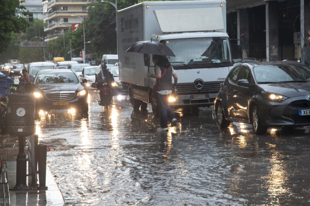
– To avoid crossing torrents and streams, on foot or by vehicle, during storms and rainfall, and for several hours after they end. Particular attention is needed at points on the road network where the road intersects with torrents and there is no bridge.
– To avoid outdoor work and activities in marine and coastal areas during severe weather phenomena (risk from lightning strikes).
– To take immediate shelter during hailstorms. Seek refuge in a building or car and do not leave the safe space until certain that the storm has passed. Hailstorms can be very dangerous for animals too.
– To avoid passing under large trees, under suspended signs and generally areas where light objects (e.g. flower pots, broken glass etc.) may detach and fall to the ground (e.g. under balconies).
– To faithfully follow the instructions of the competent local authorities, such as Traffic Police etc.
In areas experiencing intense lightning activity:
If you are at home
• Do not hold electrical appliances or the telephone as lightning can pass through cables. Disconnect television sets from the antenna and electrical power supply.
• Avoid touching plumbing pipes (kitchen, bathroom) as they are good conductors of electricity.
If you are in a car
• Pull over to the side of the road away from trees that might fall on it.
• Stay inside and turn on hazard warning lights until the storm subsides.
• Close windows and do not touch metal objects.
• Avoid flooded roads.
If you are in an outdoor space
• Seek shelter in a building or car, otherwise sit immediately on the ground without lying down.
• Take shelter under solid branches of low trees if you are in a forest.
• Never take shelter under a tall tree in an open space.
• Avoid low-lying areas due to flood risk.
• Do not stand near pylons, electrical transmission lines, telephone lines and fences.
• Do not approach metal objects (e.g. cars, bicycles, camping equipment etc.).
• Stay away from rivers, lakes or other bodies of water.
• If you are in the sea, get out immediately.
• If you are isolated in a flat area and feel your hair rising (indicating that lightning will soon occur), squat deeply with your head between your legs (to minimize your body surface area and contact with the ground) throwing away any metal objects you have on you.
EMU: The weather deterioration forecast
According to the Emergency Bulletin of Dangerous Weather Phenomena (EBEKF) issued today Monday, January 5, 2026 by the National Meteorological Service (EMU), heavy rains and storms are forecast from the early morning hours of Tuesday (06-01-2026) until the morning hours of Thursday (08-01-2026) in most areas of western and northeastern Greece. It is noted that the rainfall will be both of great intensity and long duration. The severe phenomena in many areas will likely be accompanied by local hailstorms and at intervals by strong winds of 8 to 9 Beaufort scale.
Specifically, locally severe rains and storms are forecast:
Tomorrow Tuesday (06-01-2026)
a. In the Ionian islands (mainly Corfu, Lefkada, Kefalonia region)
b. In Epirus (mainly regional units of Thesprotia, Preveza, Arta in the west and Ioannina in the west)
c. In western Central Greece (mainly regional unit of Aetolia-Acarnania)
d. In eastern Macedonia and Thrace from afternoon hours (orange warning)
Day after tomorrow Wednesday (07-01-2026)
a. In the Ionian islands (mainly Corfu, Lefkada, Kefalonia region)
b. In Epirus (mainly regional units of Thesprotia, Preveza, Ioannina, Arta)
c. In western Central Greece (mainly regional unit of Aetolia-Acarnania)
d. In western and southern Peloponnese from afternoon hours until late at night (orange warning)
e. In eastern Macedonia and Thrace until late at night (orange warning)
The severe phenomena from the morning hours of Thursday (08-01-26) are expected to gradually weaken, however the severe weather is forecast to continue in most areas of the country with different local characteristics.
Citizens can stay informed daily about the evolution of emergency weather phenomena in the regular weather bulletins of EMU and on the EMU website at www.emy.gr, (www.oldportal.emy.gr)