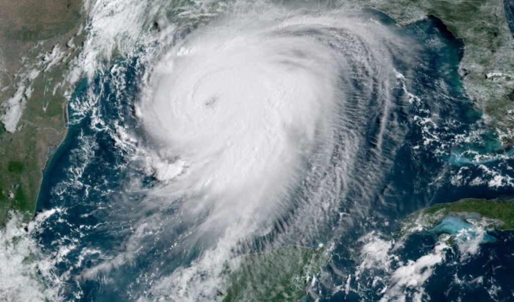
The El Niño phenomenon is strengthening, warns meteorologist Sakis Arnaoutoglou, as the latest data indicates it is expected to reach very high intensity during the autumn and winter of 2026-2027. The American agency NOAA estimates the probability of a very strong episode at over 90%. For Greece, however, the development of El Niño alone is not enough to predict next winter’s weather. As Sakis Arnaoutoglou points out, atmospheric circulation over the North Atlantic will be of particular importance.
Read: Panama declares state of emergency due to El Niño — restrictions at the Canal
Key factors will include where high-pressure systems establish themselves, the tracks that low-pressure systems follow, and whether the right conditions develop for cold air masses from northern and eastern Europe to be directed toward the Balkans and the eastern Mediterranean.
Sakis Arnaoutoglou notes that a winter can, on the whole, be recorded as warmer than normal while still featuring one or more powerful cold spells. For snowfall to occur across the country, a specific combination of factors is required — sufficiently cold air masses, available moisture, and the right positioning of pressure systems.
These precise details, according to the meteorologist, cannot be reliably forecast many months in advance, as the picture for Greece will begin to become clearer in October and especially in November.
Sakis Arnaoutoglou’s full post
El Niño is strengthening significantly. What could this mean for the 2026–2027 winter in Greece?
The latest data from the Pacific now carries enough weight to look more seriously at the coming winter. Not to produce a winter forecast for Greece as early as August — that would be premature, not to say foolish — but because one of the most important factors influencing global atmospheric circulation is developing with unusual intensity.
On August 13, 2026, NOAA — the American agency that monitors the atmosphere and oceans — assigned over a 90% probability that El Niño would reach very strong intensity during the autumn and winter of 2026–2027. For the October–November–December quarter specifically, it gave a 69% probability that El Niño could reach a level surpassing in intensity all previously recorded episodes since 1950.
And this is not merely a model projection. In the update of August 24, 2026, the temperature anomaly in the Niño 3.4 region had already (see map) reached +1.8 degrees Celsius. Niño 3.4 is a large area of the tropical Pacific near the Equator that scientists use as a kind of “thermometer” for tracking the evolution of El Niño. Further to the east, anomalies were even larger.
However, this does not mean we already know what the weather will be like in January in Thessaloniki, Athens, or Florina.
This is perhaps the most important point in the discussion. El Niño is an unusually large warming of the waters across a vast area of the tropical Pacific. When this warming becomes intense, it affects the atmosphere above the ocean and from there can alter the behavior of large-scale atmospheric currents in very distant parts of the planet.
In North America, this effect is usually clearer. In Europe, however, things are far more complex. By the time the El Niño “signal” reaches us, it has to pass through the Atlantic, large-scale anticyclones and low-pressure systems, conditions over the Arctic, and several other factors.
This is why particular caution is needed when we see seasonal maps with nearly all of Europe colored red. Seasonal forecast models do not tell us what the weather will be on a specific day. They attempt to estimate whether, averaged over a long period, temperatures or rainfall are more likely to end up above or below normal levels.
Copernicus, the European Earth and climate monitoring program, states this quite clearly: in Europe, the uncertainty of seasonal forecasts is greater and the ability to forecast correctly is lower than in tropical regions.
So a very strong El Niño is an important piece of the puzzle.
But it is not the whole puzzle. For Greece, what happens in the North Atlantic will play a decisive role. In simple terms, what matters is where the large high-pressure systems settle, where low-pressure systems track, and whether the pathway opens or closes for cold air masses from northern and eastern Europe to flow toward the Balkans and the eastern Mediterranean.
A winter, therefore, can ultimately be characterized as warmer than normal while also containing one or two very strong cold spells. Imagine December being fairly mild, followed by a ten-day period of very low temperatures in January, after which southerly winds and higher temperatures return. The final winter average could turn out positive, without that meaning we didn’t experience a real winter.
The same applies to snowfall. Based on the data available today, no one can seriously claim that a very strong El Niño means “a winter without snow in Greece.” For snow to fall across the country, specific conditions must coincide — sufficiently cold air, moisture, and the correct positioning of pressure systems. These details cannot be reliably predicted months in advance.
Another factor that will occupy our attention as we approach winter is the polar vortex. Despite its name, it is not a massive tornado. It is a very large circulation of powerful winds high in the atmosphere around the Arctic, which helps keep very cold air more concentrated in the polar regions. When the polar vortex remains strong, most of the cold is typically contained further north.
If it weakens or is significantly disrupted, however, the chances increase that portions of this very cold air will move southward. Where exactly they move is another matter entirely. They could be directed toward America, toward western Europe, toward eastern Europe, or — under specific conditions — toward the Balkans.
This is why the picture for Greece will start to become much more interesting in October and especially in November. By then, we will have a better understanding of where El Niño is peaking, how the Atlantic is behaving, and what state the circulation around the North Pole is in.
There is, however, another dimension to this discussion that often stays off the meteorological maps — and one I now see from my position as a Member of the European Parliament.
Weather and climate do not stop at meteorological charts. They are directly connected to energy, agriculture, water reserves, civil protection, and ultimately to people’s daily lives and costs. This is why timely scientific information has value — not only to know what may be coming, but also to prepare better. An unusually mild, wet, dry, or unstable winter can affect energy consumption, agricultural output, water management, and readiness for extreme weather events. Because the value of a forecast lies not only in whether we ultimately “got it right” — it also lies in whether we used what we knew in time to be better prepared.